Chris Lowe Posted February 17 Report Share Posted February 17 These are Nissen huts, made with corrugated steel sheets, & nissen is spelt with an E, Nissan is a car manufacturer. Drawing isn't very clear but this is a Handcraft Hut. I may have a better copy in my collection of Air Ministry drawings. As they are handcraft, it points to that site possibly being a miltary depot of some kind Link to comment Share on other sites More sharing options...
Rob-M Posted February 17 Report Share Posted February 17 Where is this roller...? Link to comment Share on other sites More sharing options...
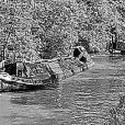
Stroudwater1 Posted February 18 Report Share Posted February 18 Is that on the railway bridge at the Stone locks, T&M? I only saw two of these one on the Cheshire locks and this one. Im sure there must have been more? 1 Link to comment Share on other sites More sharing options...
beerbeerbeerbeerbeer Posted February 18 Report Share Posted February 18 (edited) Yeah, I think that’s Lime Kiln Lock we can see. The one I remember on the Cheshire flight is at the bottom of one of the locks at the lock mouth (and not on a bridge) Edited February 18 by beerbeerbeerbeerbeer 1 Link to comment Share on other sites More sharing options...
Heartland Posted February 18 Author Report Share Posted February 18 May be this lock then and the railway bridge Link to comment Share on other sites More sharing options...
Rob-M Posted February 18 Report Share Posted February 18 1 hour ago, Stroudwater1 said: Is that on the railway bridge at the Stone locks, T&M? Yes it is. Link to comment Share on other sites More sharing options...
beerbeerbeerbeerbeer Posted February 18 Report Share Posted February 18 (edited) Ok, here’s a nice little easy starter for 10, a favourite spot of mine , an area where each time I pass I learn a little more, at the same time I realise how much more there is that I don’t know, so many layers of history here it maybe crystal clear for those who know the BCN, but for those who don’t you deserve this clue to give you chance Edited February 18 by beerbeerbeerbeerbeer Link to comment Share on other sites More sharing options...
beerbeerbeerbeerbeer Posted February 19 Report Share Posted February 19 There’s a canal below, train line beside, a motorway above, and Chance made glass for Crystal Palace, Link to comment Share on other sites More sharing options...
Rob-M Posted February 19 Report Share Posted February 19 1 hour ago, beerbeerbeerbeerbeer said: There’s a canal below, train line beside, a motorway above, and Chance made glass for Crystal Palace, I knew I recognised it but couldn't think where on the BCN, but must be near Stewart aqueduct. Link to comment Share on other sites More sharing options...
beerbeerbeerbeerbeer Posted February 19 Report Share Posted February 19 (edited) getting warm, very warm Edited February 19 by beerbeerbeerbeerbeer Link to comment Share on other sites More sharing options...
David Mack Posted February 19 Report Share Posted February 19 Spon Lane Bridge. The towpath for the Spon Lane Locks branch crosses over the Old Main Line here. Link to comment Share on other sites More sharing options...
beerbeerbeerbeerbeer Posted February 19 Report Share Posted February 19 👍 yes, if you looked the other way you’d see the top lock Link to comment Share on other sites More sharing options...
Heartland Posted February 19 Author Report Share Posted February 19 You mean this bridge? Link to comment Share on other sites More sharing options...
beerbeerbeerbeerbeer Posted February 19 Report Share Posted February 19 Yep, Lots to look at around here, CRT are missing out they could be charging £20 a night to moor under the M5 Link to comment Share on other sites More sharing options...
Heartland Posted February 19 Author Report Share Posted February 19 If you look close at the image I posted you will see a bricked up arch that was once the entrance to a lock, what lock number was it and when did it cease to be a lock? And another question for the grey cells? Link to comment Share on other sites More sharing options...
beerbeerbeerbeerbeer Posted February 19 Report Share Posted February 19 (edited) Lock 9? When the summit pound was higher. I’ll have to look up the date 😃 1790 Is that Smethwick Junction? no it’s not, forget I said that Edited February 19 by beerbeerbeerbeerbeer Link to comment Share on other sites More sharing options...
Heartland Posted February 19 Author Report Share Posted February 19 Yes it would be lock 9 and 1790 is about right although a couple of years were needed to move the canal. I suppose there are still bits of lock 8 under the motorway piers As to the recent image there was once a tube works beside a street now gone with links to an Egyptian River. Link to comment Share on other sites More sharing options...
Rob-M Posted February 19 Report Share Posted February 19 Smeaton lowered the summit in 1786-87. Link to comment Share on other sites More sharing options...
Victor Vectis Posted February 19 Report Share Posted February 19 24 minutes ago, Heartland said: As to the recent image there was once a tube works beside a street now gone with links to an Egyptian River. Middle of Birmingham. Near the entrance to the Oozells Loop. I thought thats where it might be but confirmed by looking at the 1918 25" OS map. Albion Tube Works and Nile Street. Link to comment Share on other sites More sharing options...
David Mack Posted February 19 Report Share Posted February 19 1 hour ago, Heartland said: If you look close at the image I posted you will see a bricked up arch that was once the entrance to a lock, what lock number was it and when did it cease to be a lock? 1 hour ago, beerbeerbeerbeerbeer said: Lock 9? When the summit pound was higher. I’ll have to look up the date 😃 1790 I have wondered whether that bricked up arch was a remnant of the locks leading up to Brindley's summit, but the bridge looks of rather later date than 1790. So am I wrong about the bridge date, or did the entrance to the old lock survive after 1790 for other reasons? Link to comment Share on other sites More sharing options...
beerbeerbeerbeerbeer Posted February 19 Report Share Posted February 19 (edited) 39 minutes ago, Victor Vectis said: Middle of Birmingham. Near the entrance to the Oozells Loop. I thought thats where it might be but confirmed by looking at the 1918 25" OS map. Albion Tube Works and Nile Street. I was thinking similar but the image is messing with me head, it must be the footbridge at the entrance to the loop? but I can’t work it out 23 minutes ago, David Mack said: have wondered whether that bricked up arch was a remnant of the locks leading up to Brindley's summit, but the bridge looks of rather later date than 1790. So am I wrong about the bridge date, or did the entrance to the old lock survive after 1790 for other reasons? looks like it should have been built by railway company dont it? with the engineering bricks the BCN is a mass of puzzles Edited February 19 by beerbeerbeerbeerbeer Link to comment Share on other sites More sharing options...
Victor Vectis Posted February 19 Report Share Posted February 19 I think it's the one between Old Turn Jn. and Sheepcote St. Visitor moorings, Cast Iron Roving Bridge according to Canalplan. Odd to think I walked over it on Saturday. Link to comment Share on other sites More sharing options...
beerbeerbeerbeerbeer Posted February 19 Report Share Posted February 19 1 minute ago, Victor Vectis said: I think it's the one between Old Turn Jn. and Sheepcote St. Visitor moorings, Cast Iron Roving Bridge according to Canalplan. Odd to think I walked over it on Saturday. but the one in photo ain’t cast iron is it? I’m trying to remember and by looking at photos I think the footbridge at the entrance is the only one in that area not cast, Link to comment Share on other sites More sharing options...
David Mack Posted February 19 Report Share Posted February 19 1 hour ago, beerbeerbeerbeerbeer said: but the one in photo ain’t cast iron is it? I’m trying to remember and by looking at photos I think the footbridge at the entrance is the only one in that area not cast, The towpath bridge over the Eastern end of the Oozells Street loop was replaced some years ago - probably when the area was being redeveloped. The old bridge was a riveted truss like the one in the photo, so I guess this is it, taken when the old bridge deck was being separated from the abutments in preparation for its removal. 1990s? 1 Link to comment Share on other sites More sharing options...
Heartland Posted February 20 Author Report Share Posted February 20 Well Firstly "Smeaton lowered the summit in 1786-87." RE SMETHWICK SUMMIT REDUCTION YE GODS FALSE HISTORY !!!!!!!!!!!!!!!!!!!!!!!!!!!!!!!!!!!!!! John Smeaton provided assistance for the BCN when it was the BIRMINGHAM CANAL NAVIGATION, but the summit reduction was undertaken by their successors Birmingham & Birmingham & Fazeley Canal Company and the work was undertaken under the engineers James Bough and Samuel Bull who were employed by the BBFC. Samuel Bull lived at Smethwick. The work done at Smethwick was a tad later 1788-1791 Smeaton recommended water savings, new water supplies and a canal to Digbeth with engines to back pump the water supply amongst many things in his reports, The need for the Smethwick Summit reduction had been apparent for a time, but new impetus came with the making of Birmingham & Fazeley Canal to Fazeley and the branches at Ryders Green and to Digbeth. Bull and Bough deserve credit in this regard. As to the image yes it is the Junction at Old Turn and Deep Cutting and the view is the bridge over the Oozells Loop which was was the original BCN of 1769. The tube works was Nile Street. Link to comment Share on other sites More sharing options...

Featured Posts
Create an account or sign in to comment
You need to be a member in order to leave a comment
Create an account
Sign up for a new account in our community. It's easy!
Register a new accountSign in
Already have an account? Sign in here.
Sign In Now