Heartland
-
Posts
3,397 -
Joined
-
Last visited
2 Followers


Heartland's Achievements
")
Veteran (11/12)
418
Reputation
-
Enforcement, I agree may well help and may be it should be a topic to consider in the forth coming elections. On the roads and footpaths there is the problem of Deliveroo and Just Eat cyclists, electric cyclists and even ic powered scooters who regularly are odds with the Highway Code. These abuses can no doubt be seen by those who monitor the cameras in certain places. May be the companies should be fined as a way to get their staff to follow the rules.
-
Hiring boats can be expensive at certain times of the year and that can be a factor. Visiting Birmingham is worthwhile and recommended and there are some canal such as the Wyrley & Essington and Tame Valley that deserve more boats to explore their routes. The cyclists and scooter owners remain it seems to be a deterrent and it sad the CRT has not more to regulate the more antisocial aspects that tarnishes all the good and care the sensible cyclists do. As to the electric scooter users their use should be regulated more and it should be recognised that they are banned on the Rail Network. Towpath improvement has contributed to the higher speeds of bikes and scooters and those that moor up can be confronted by those that do speed past their boat. CRT seem totally oblivious of the Risk Assessment and Health and Safety concerns.
-
Cotswolds Archeology are working on route of the A66 upgrade and have come across evidence of early communities and water channels. In relation to the time line for canals this must rank as early.
- 1 reply
-
- 1
-

-
If I recall Gibsons Arm in Birmingham had paddles on the same side of the lock in Cambridge Street will have to check
-
I can only wish them well. These are difficult times where appeals to politicians may fall on stony ground, however. When CRT was set up there was an element for them to find funds from a variety of sources and not rely on a grant. Our current political warlords have a different agenda as to where they distribute cash!
-
With the RCHS AGM which was held in Lichfield in 1998 we visited Darnford Lane when the lift bridge was a relative new addition. The length of time to get navigations restored demands great dedication.
-
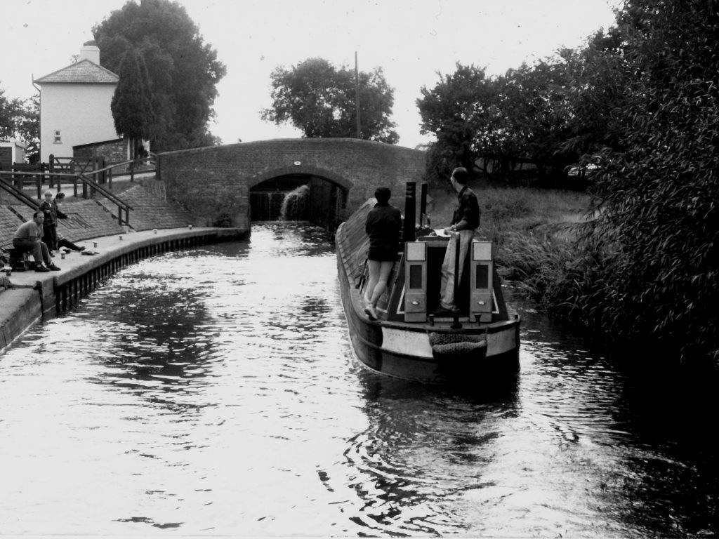
Thanks folks, it does look like Stockwith
-
This post cannot be displayed because it is in a forum which requires at least 10 posts to view.
-
Yus I was on the hire boat behind Steve Crook and I had gone out from Water Travel, Wolverhampton with the intention of going on a week trip to Shardlow. This was our second week trip out with that firm. These trips and with other hirers helped with illustrations in subsequent canal books. Other trips on Hecla also helped, but getting used to the traditional controls on Hecla was very different to a hire boat. Hire boat controls could with some hirers provide a useful speed. In 2006 we had a Shire Cruiser trip to Sheffield and on going up from Rotherham we accompanied a group of boaters with whom we moored at Rotherham. That group wanted to keep us behind them as Sheffield Basin had limited accommodation, after all we were the lowest of the low, hire boaters, not realising our experience with boating. Not every body can afford to buy and keep a boat. Before setting off we told the lead boat we would take water at the lock. After the water stop we then went full speed past them and went to the head of the boats for Tinsley Locks and reached Sheffield Basin first.
-
When did canal companies use paddle gear made on the slant. What were the advantages of such a practice?
-
This is a video that shows the restoration progressing toward the Coventry Canal. It would appear that the New Cappers Lane Bridge will not be finished until 2027, but will there be a link through from the Coventry Canal to Lichfield and that when it happens will be a watershed moment
-
This image for example Hugh Compton Collection in this case Regarding Any ideas ? This canal had narrow bits and wide bits and along the main line a short section of river was incorporated and they also later did the same with two other parts of their network. One of this latter group closed to canal traffic in January 1848.

-
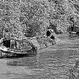
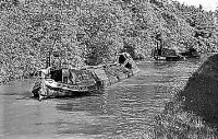
I did wonder if this was Nottingham Canal having seen images of barges such as these in an RCHS collection
-
Yes regarding the Daneway. It is the canal bed very recently cleared of vegetation. It presents a better view of the wharf and the entrance to the side basin A CRT image shows the location before closure- Now this image from the 1990's shows a barge wide canal which was close to an earlier river navigation It would be of interest to identify those on the working boat, As to Brierley Hill, the name Level was given to a drain or mine adit into the hillside. Here the adit brought out ironstone and coal and gave its name to the Old Level Furnaces and the New Level Furnaces Later Round Oak ironworks was developed by Richard Smith agent to the Earl of Dudley. Later still the ironworks became a steel works which lasted until the 1980's when the works closed and were redeveloped as the Merry Hill Centre. In our age the Posdisriminators would clap with glee as to removal of the nasty polluters now gone. At the time it was a sad loss for jobs.
-
Andrew Barclay four couple saddle tank and a ladle waggon, nice pub there once and the street is called Level Street ----- why ? No doubt Victor has steeled himself for any replies that relate to a tree circumference ? And for beer beer etc the pub has gone And, whilst people reflect another for the grey cells and a substantial tree growing on the canal bed!