Tom Morgan
-
Posts
153 -
Joined
-
Last visited
Content Type
Profiles
Forums
Events
Gallery
Blogs
Store
Everything posted by Tom Morgan
-

What is your latest purchase, bargain, 'must have gadget' ?
Tom Morgan replied to Alan de Enfield's topic in General Boating
Miles away, I should think. I've locked the boat up and gone home a few times since I got it, and it always works when I go back. -
What is your latest purchase, bargain, 'must have gadget' ?
Tom Morgan replied to Alan de Enfield's topic in General Boating
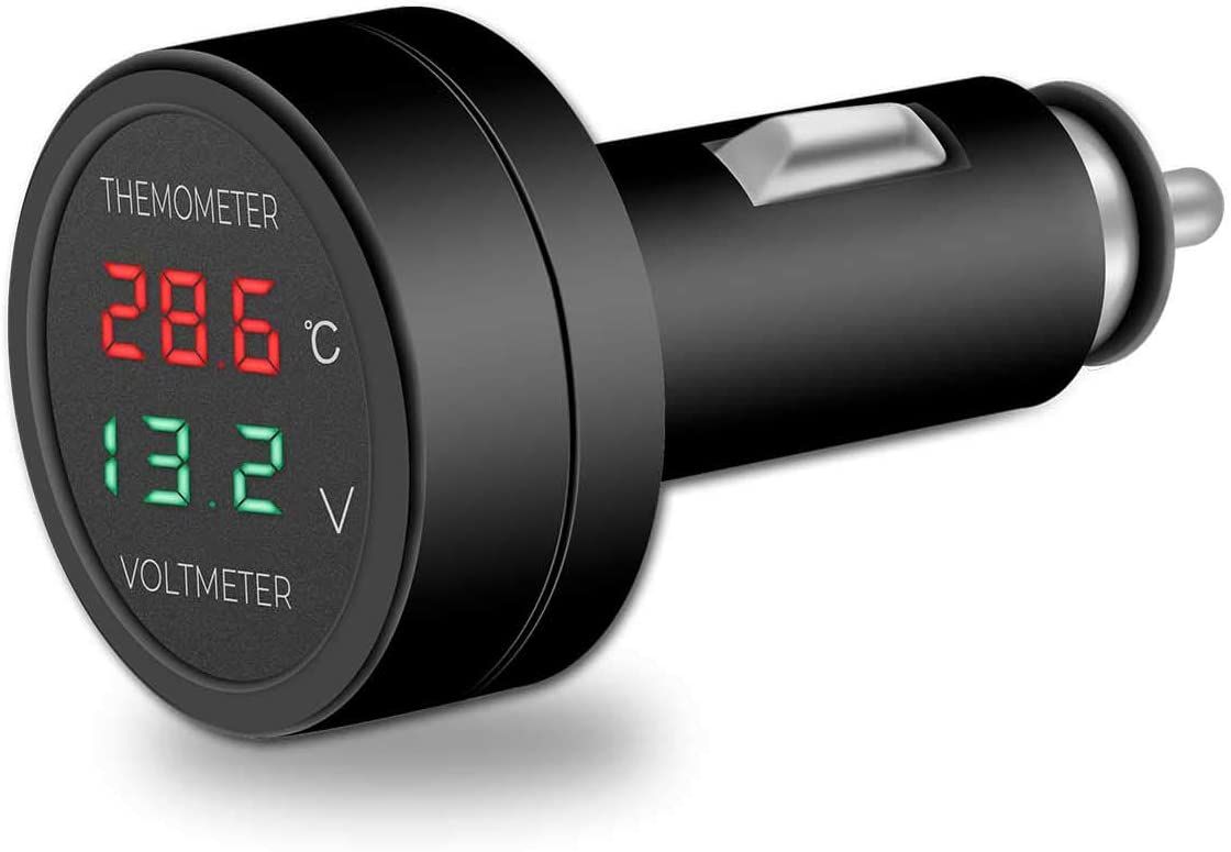
I bought one of these to give a rough idea of how my battery's doing.
-
I have one of those. I was delighted to learn (after letting it slip out of my hand while going through a lock) that it floats!
-
That's Art Nouveau.
-
I had to wait a long time for my boat, Godot.
-
I would have thought that CCers have the same chances as everyone else, "boating season" or not - significantly, that you can continuously cruise on any part of the system that's open to navigation at the time. Unforeseen circumstances are always going to lead to some closures, regardless of the time of year.
-
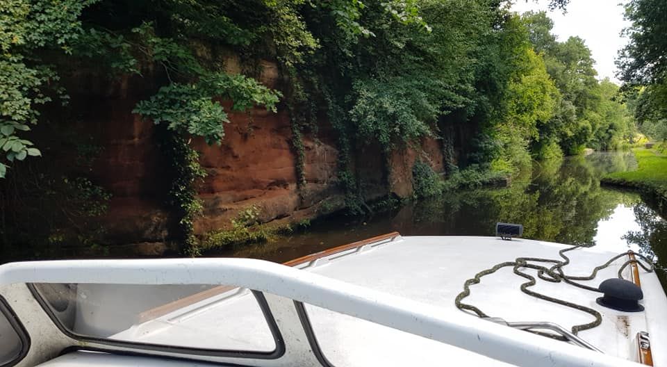
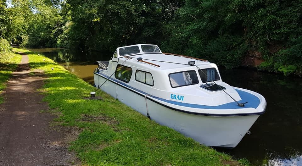
On this day, last week. A little cruise on the Staffs and Worcs. Met some friendly boaters, cleaned the side of the boat I can't normally reach when in the marina, watched a narrowboat steerer put the bow into a lock landing, put a crew member off with a bow rope and then try to jump the three feet or so from the stern to the towpath, with the inevitable result, met some friendly boaters at the locks and passed through some beautiful scenery.
-
With a really good fish and chip shop next-door-but-one.
-
What have you fettled for the boat today?
Tom Morgan replied to Captain Fizz's topic in Boat Building & Maintenance
Fitted a pair of handed cleats to the (wooden) handrails of my Norman, to make it easier to use the bow rope as a centre line at lock landings. -
I downloaded an app that uses GPS to record MPH. Using that, I soon got used to the engine revs needed to maintain that speed. I don't have a rev counter so I put a mark on my control lever housing to mark that speed and just used that as a very rough guide, making allowances for "wind assistance" or the opposite. Now, of course eyesight alone is a reliable indicator. Generally, I like to cruise a bit slower than 4MPH, anyway. I slow right down for bridges and moored boats. My boat's a GRP cruiser which pushes the water down, under and out the back, so it doesn't take much to cause quite a wake. That's another visual guide I use. As far as being on the receiving end is concerned, a light (2 tons) boat like mine doesn't half get bounced about when a big narrowboat speeds past!
-
I'm not an expert, but 8hp seems a little underpowered for such a heavy boat on a river. (I say "heavy" by comparison to my GRP 23-footer, which has a Honda 9.9hp outboard on the canals). The max speed I've ever got on a really wide bit of canal one day, was 7 mph. I would worry about taking it on a river.
-
Responsibilities of marina during Covid restrictions
Tom Morgan replied to Momac's topic in General Boating
I'm still happy to police myself, which is largely how the country used to run itself when I was a lad. -
"Broken Bridge" on the Tame Valley Canal.
Tom Morgan replied to Tom Morgan's topic in History & Heritage
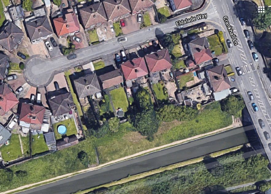
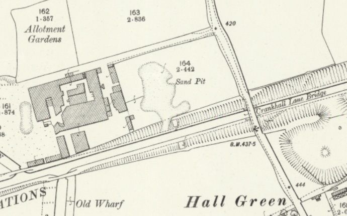
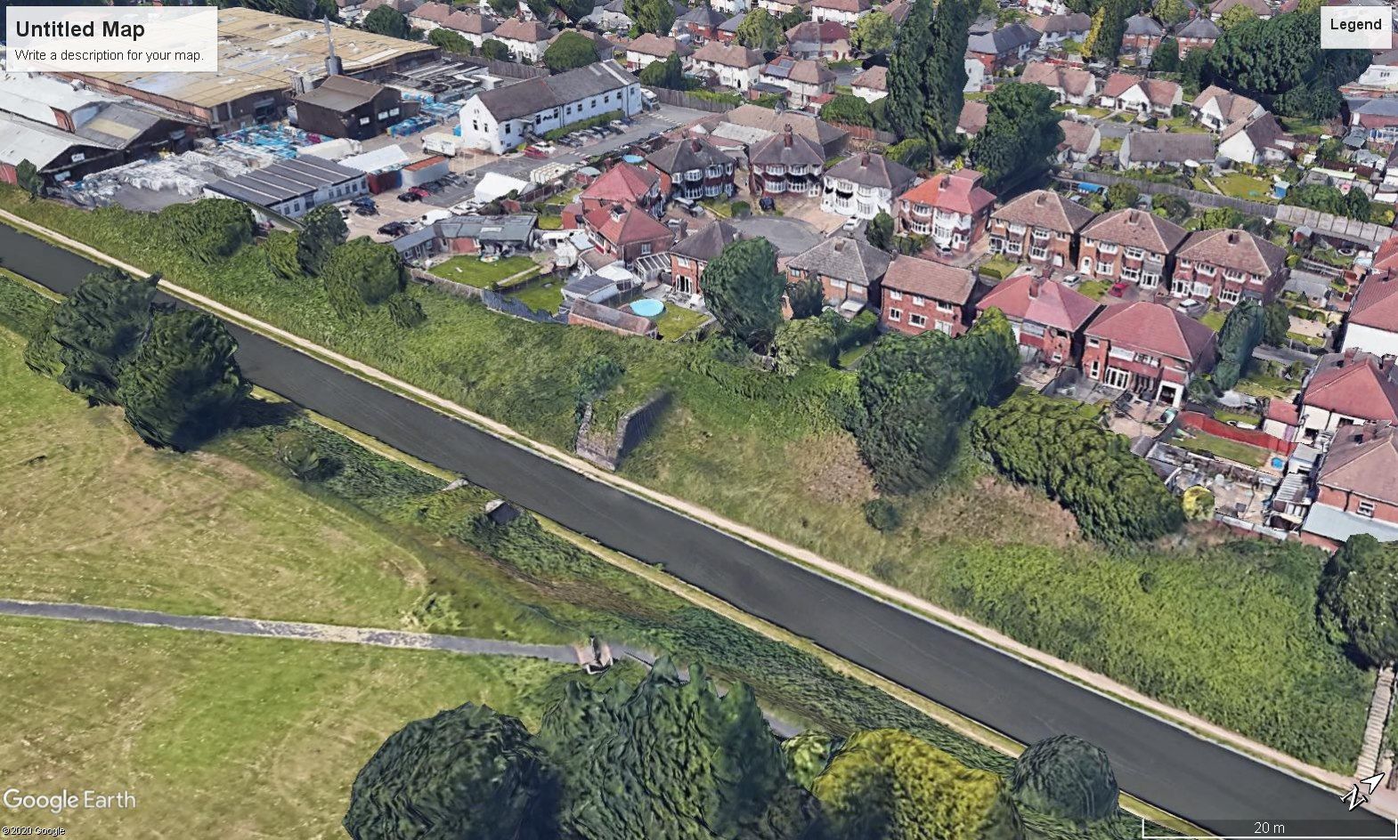
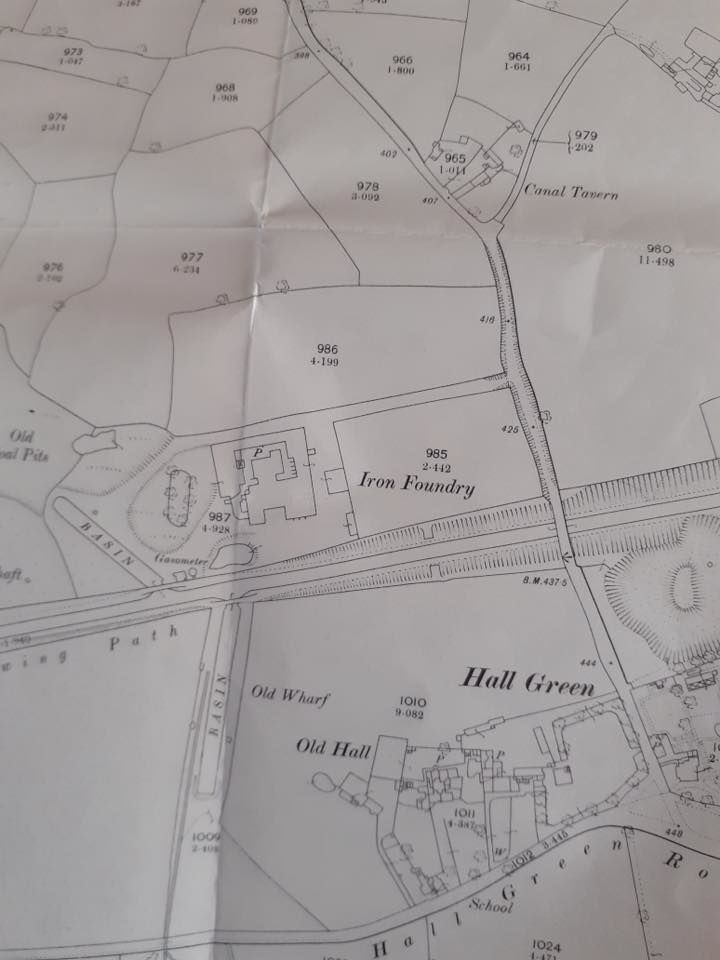
When I got home and saw the photos on my PC, I noticed that, too. You can see the passageway, and where it emerges, on the Google Earth aerial below. It comes out into a late-1930s cul-de-sac. If you look at the second image, a 1903 map of the area, you can see the iron foundry, with its own canal wharf and access road to Crankhall Lane. This access road still exists in the same location, accessing the commercial laundry premises which now occupy the iron foundry site. It runs alongside the back garden fences of the houses on the northern side of the cul-de-sac. The rectangular area marked "Sand Pit" on the map coincides exactly with the area on which the cul-de-sac and its gardens are now.
-
"Broken Bridge" on the Tame Valley Canal.
Tom Morgan replied to Tom Morgan's topic in History & Heritage
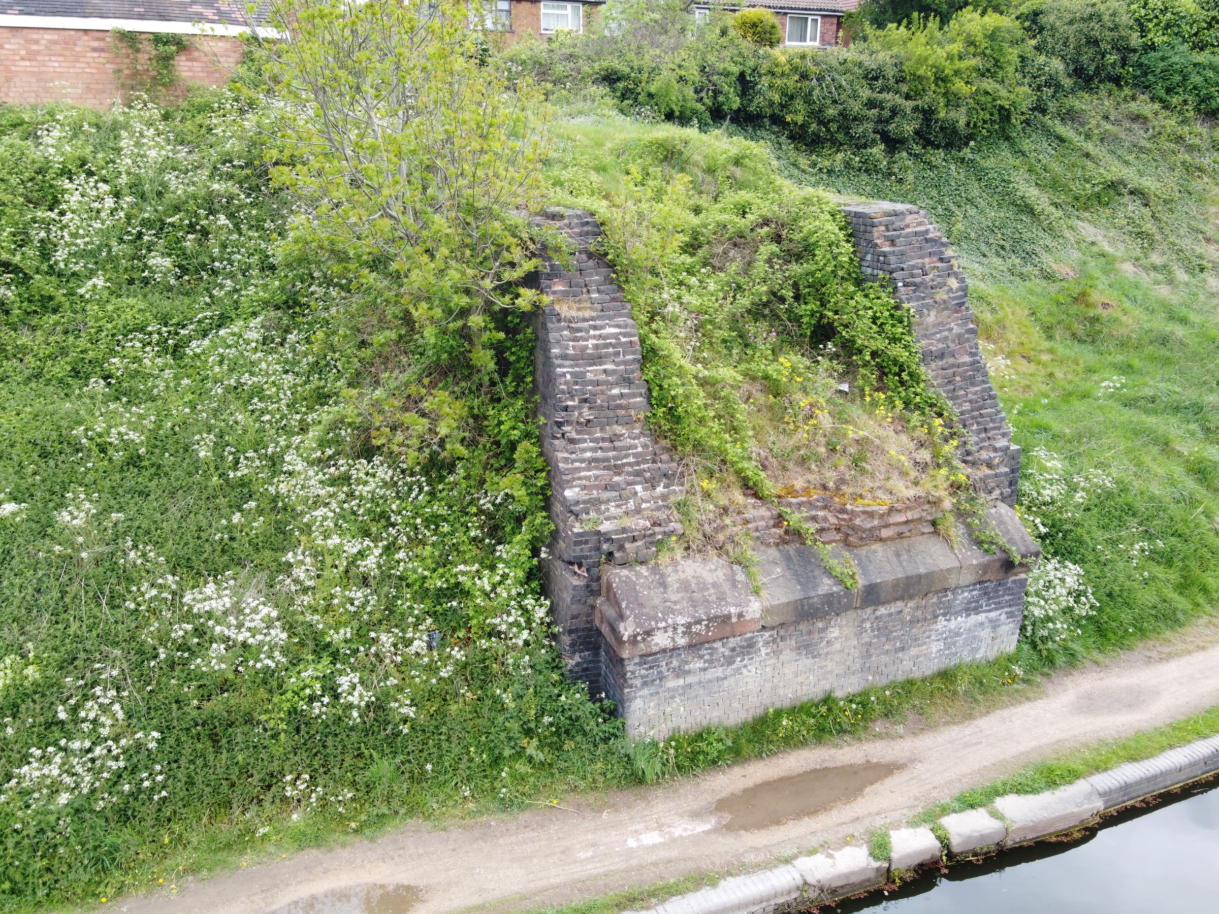
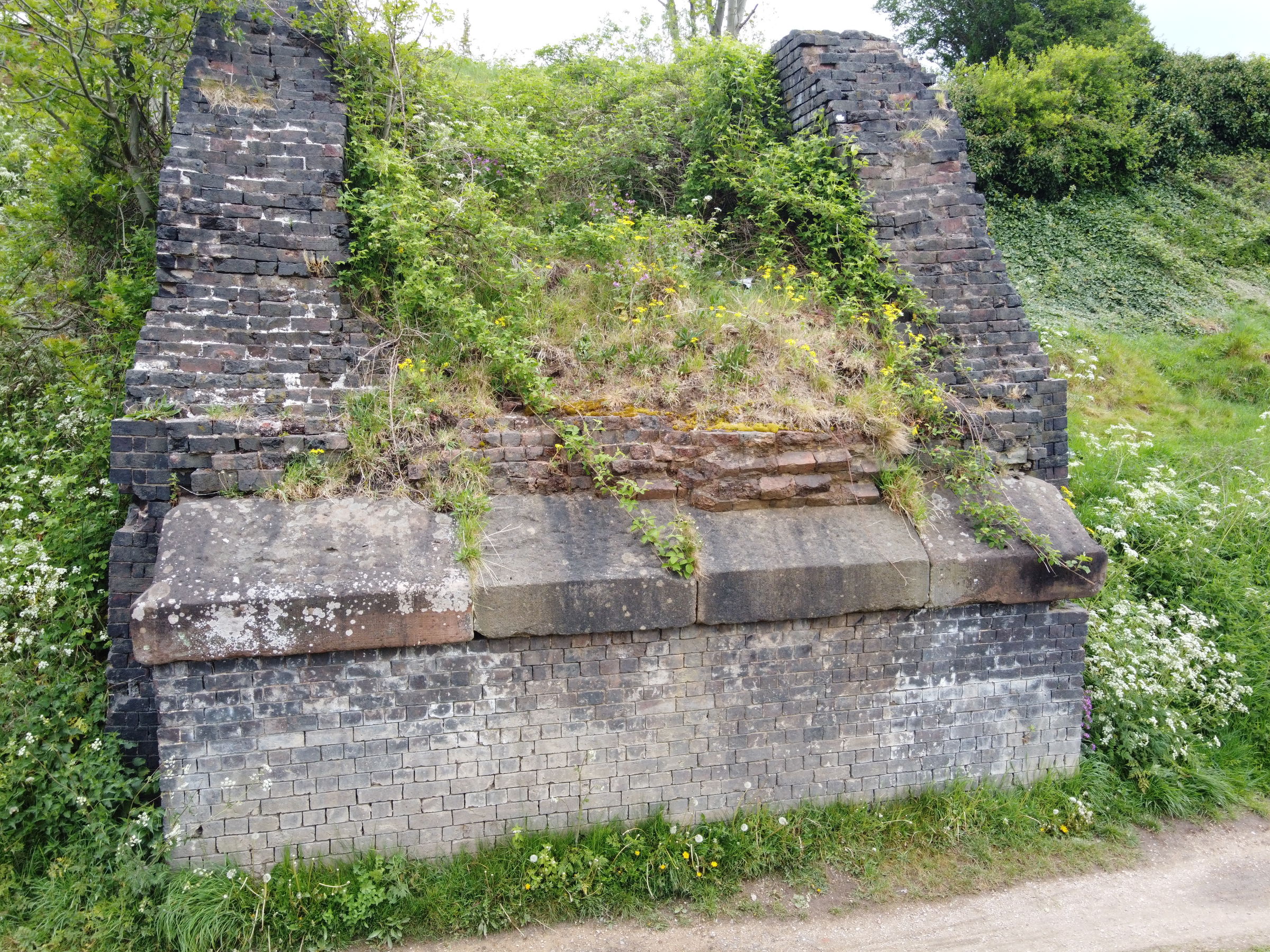
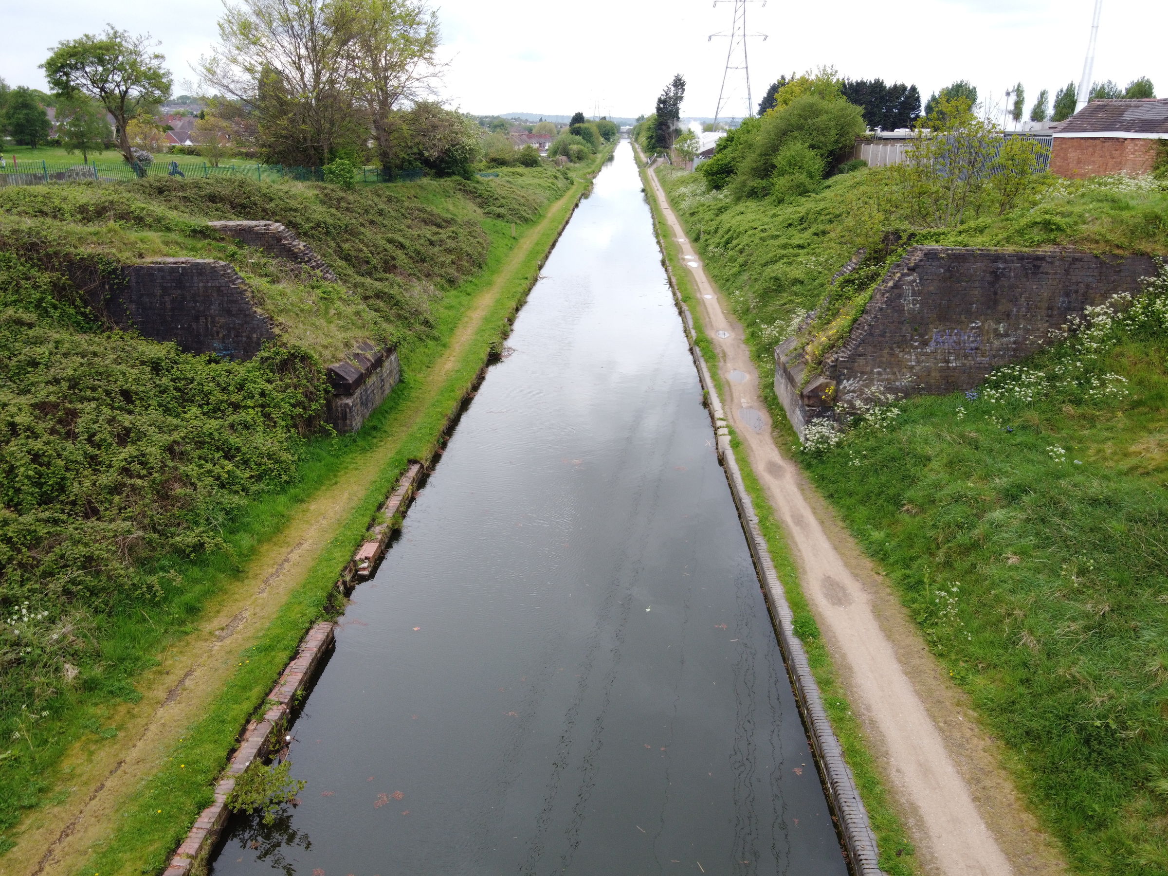
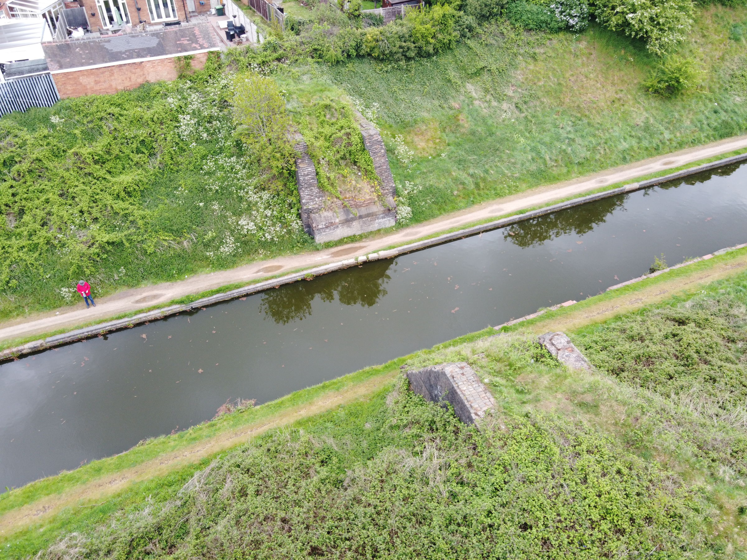
Just in case a closer look at the remaining structures might give anyone any clues, I walked over there this morning (I live about half a mile away) and took a few photos: In order - North Abutment, South Abutment, Aerial (sides), Aerial (above).
-
I wonder if anyone has any information on a former bridge over the Tame Valley Canal. The only remnants today are the brick and stone buttresses on either side of the towpaths. I'm trying to find out what this bridge was originally called, and, if possible, why it's no longer intact. Demolished? Collapsed? The location is 87 metres West from Crankhall Lane Bridge - i.e. heading away from Birmingham. If I can I'll add a photo of the remains and a map of about 1914, showing the two buttresses - the two rectangular features on the towpaths just below the words "Iron Foundry" in the centre of the map.
-
Can a boat in a closed marina be declared off water?
Tom Morgan replied to Duke 1956's topic in Frequently Asked Questions
Content deleted - didn't read the question carefully enough, so my answer was not relevant! -
It's a Sector, also known as a Proportional Compass.
-
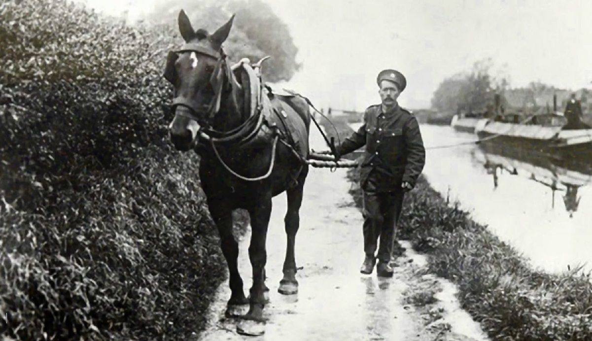
I'm always impressed at how accurately members can pinpoint modern canal locations from old photos. There isn't much to go on in this photo but I thought I'd ask. From his cap-badge, this man could be a soldier in the Royal Engineers, so I assume he's from the Inland Waterways and Docks section. Are there any clues as to the location?
-
The report says that three boats were "set on fire" and "had their moorings cut."
-
Thank you, Alan de E (and, by association) Nigel Moore. A very clear explanation for which I'm very grateful. All is clearer now!
-
Could someone explain - what is an unregistered boat as far as the EA is concerned? Have the owners not licenced their boats, or have they not informed the EA of their ownerships? (And presumably not licenced them, either).
-
This post cannot be displayed because it is in a forum which requires at least 10 posts to view.
-
Yes - I read about the Shelmore Embankment becoming necessary when a landowner insisted on the canal being diverted from a proposed path through his woodland. (If I remember correctly).
-
You don't have to be a relative to be upset by some of the jokey comments. Somebody has possibly/probably died.
-
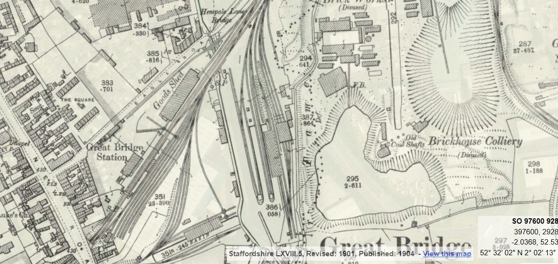
Here is a 1904 map showing the railway transhipment wharf at Great Bridge, near West Bromwich.