Francis Herne
Patron-
Posts
461 -
Joined
-
Last visited
-
Days Won
1
Content Type
Profiles
Forums
Events
Gallery
Blogs
Store
Everything posted by Francis Herne
-
Bear in mind the rule for continuous cruisers to "satisf[y] the Board that the vessel to which the application relates will be used bona fide for navigation throughout the period". In recent years CRT have interpreted this as a range of 20 miles (while moving a reasonable distance every 14 days or less), but have stopped publishing that guideline in the last year or two, I suspect as a precursor to applying more stringent criteria. In the past, BW and I think CRT have demanded much greater distances of movement with mixed success. You will find it quite hard to find spots to moor in London, particularly for a large widebeam boat, because a very large number of people have had the same idea already. Most of the towpath has moored boats end-to-end, with narrowboats often moored two abreast. Services like water, Elsan and pumpouts are congested for the same reason. CRT have begun 'solving' this for visiting boats by introducing fairly expensive pre-bookable moorings, with a limited number of days per boat per year. There is currently a consultation on introducing several more areas of this. Of course this further reduces the space available for free mooring on the towpath. The number of people "continuously cruising", but really just shuffling back and forth within London over the shortest possible distance, is increasingly being seen as a problem to be solved by CRT (and a significant proportion of boaters, including some on this forum and frankly myself). It simply isn't viable for half the population of London to live on the canals, and ludicrous housing costs are pushing ever more people that way. I would expect further changes of some sort in the next few years to make this less attractive - whether that's further increases to the CC surcharge, continued expansion of paid towpath moorings, a stricter interpretation of "bona fide navigation" or all of the above. Planning for the status quo would be unwise. The proposed Bedford - MK canal is very aspirational and has no chance of being built in the foreseeable future. No significant work has been carried out on it besides some improvements to the river at Bedford. As a Cambridgeshire native, I would like to see it too! A narrowboat can get there the long way round via Northampton but not a wider boat. I think antipathy to wide boats is overstated generally. Careless mooring of them does cause much more trouble than narrowboats as it's much easier to obstruct the channel. Disputes over mooring spaces might be an issue within London but not elsewhere. A lot of people here dislike 'widebeam narrowboats' because they're ugly and usually very badly designed as boats for navigation, or because their owners are often interested in them as a residence first and as a boat a firm second, but no-one is likely to confront you over that. You should consider that a big heavy boat will be physically harder work single-handed (mooring in crosswinds and the like, probably not viable to rope through locks so you'll be climbing ladders a lot). Manageable if you're reasonably fit, but narrowboats are easier!
-
It's always possible for something to go wrong. For instance those square wooden posts tend to rot/wear just above ground level to leave a tapered slot that's tried to grab my rope. I don't usually carry a knife, maybe I should. There's one in my 'ticket drawer' though.
-
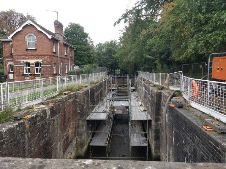
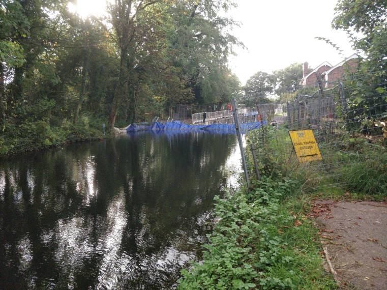
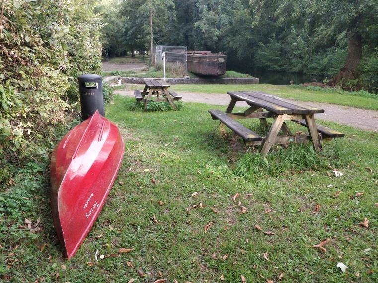
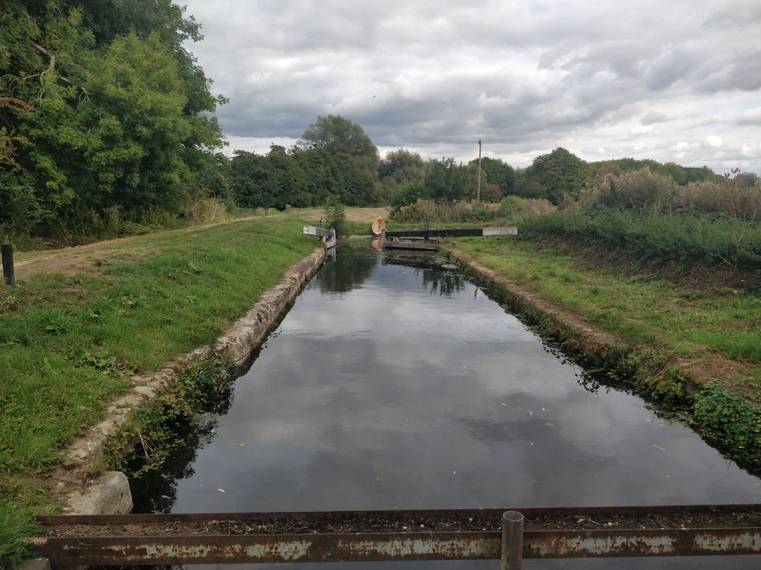
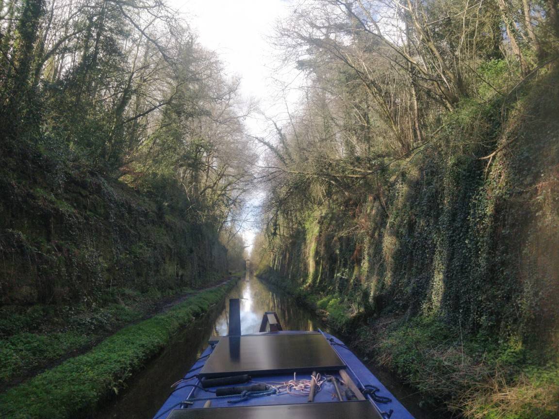
 From the A38 roundabout, it's a fairly short walk across to Fromebridge Mill, at least if you're not carrying 30kg of plywood canoe. The mill is now a pub/restaurant. I stop for a drink and some chips, then slide Too Long down quite a steep bank into the river in front. A couple of people drinking outside help me with it. For some reason I don't take a picture... A few yards round the corner is the foot of the mill weir. There's a small weir flowing swiftly behind a tree, and a much larger stone-and-concrete one that's dry in these conditions. Scramble out, drag Too Long onto the big flat area at the top, get back in and continue. (Top of Fromebridge Mill weir) The river here is a bit smaller than before, flowing mostly through open pastures, shrubby willows dotted along the banks. There's some weed at the edges but it's not in the way much. First bridge is the A38. It's oppressive, you wouldn't get a narrowboat under here, but not that low. Some cattle wonder what this peculiar red thing is. The river is a similar width here but getting shallower; occasionally I'm scraping over sandbars. Then the M5. The canal is to share this bridge, lowered a couple of feet below the river in a concrete trough for headroom. The Environment and Highways Agencies' quibbles about this have been the main source of delay in planning. In these conditions, I reckon Lark Ascending would probably have scraped under as it is. Similar to Dunn's Bridge, lower than the Droitwich culvert. Above the M5 the channel keeps narrowing. There's still some depth but the flow is increasingly fast. In some places, low branches almost reach the opposite bank - it's awkward to squeeze the canoe around them when what it really wants to do is snap around and shoot off downstream. Where Oldbury Brook merges, there's a little section of rapids. Water tumbling over brick-sized stones. I'd wondered if I could paddle up the brook to reach Westfield Lock, but it's far too overgrown. Time for a walk again. Looking beyond the rapids, the river is flowing quite fast but looks possible to paddle downstream. We'll get back to that... Across the field, there's a bridge over nothing. There should be a canal underneath but you wouldn't know it. Nor on the other side - only some scrub. This is the site of Westfield [now John Robinson] Lock, since dug out by the WRGies and others. It'll be a very different view now. Walking south from here along what was, and will again be, the canal towpath. Shortly after crossing the brook it becomes obvious - the channel has been dug out; it's almost dry and filled with standing reeds but still recognisably a canal. A plaque on the reconstructed spill weir reminds the reader of this. An empty lock, rebuilt but without gates, some more dry channel, a modern bridge but in more sympathetic style than those before. The lock on the other side is full of scaffolding and has a blue plastic dam across the top. Presumably for repairs to the walls, but no-one is around to ask. It's almost 5pm, and a few miles to walk home. Too Long can stay here until the morning. (to be continued)
-
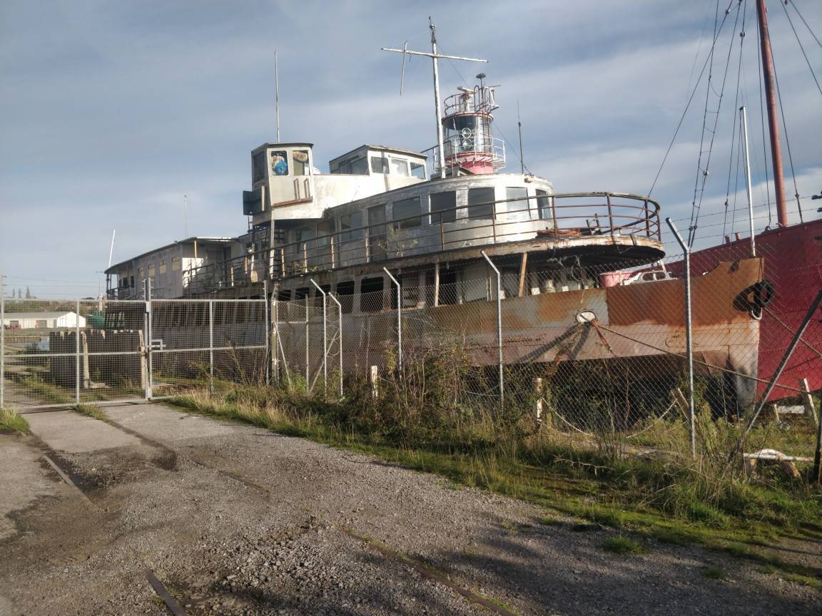
I was sure I'd taken a couple but can't find them anywhere. I moored right next to it and walked about on its deck. Definitely floating; it bumped around slightly on its chains in the wind. The picture below was taken by Bob Hallam last year. I hope he doesn't mind sharing it here. The blue wheelhouse belongs to another boat behind.
-
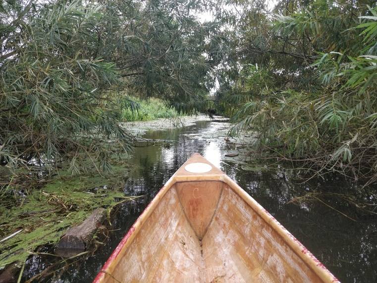
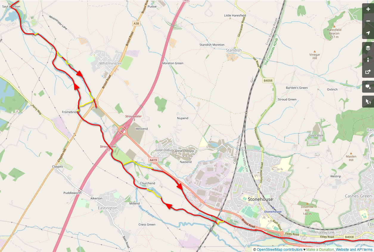
A map. The mile north of Saul is omitted for being obvious. Red by water, yellow by portage: we're only at the first yellow dash from the top. Someone familiar with the area might foresee the miserable bit. This River Frome, like some of the others, is a very pretty little river indeed. It's deep for its size and clear, tree roots dipping into the water, little fish skittering about in the dappled light. It's not long before the canal resumes on the other side and I get out to see if it's still there. It is. Too Long follows me, a bit reluctantly, over the bank into rather murkier water. Soon a pipe culvert, carrying a farm track, blocks our way. A lone flip-flop was floating in the canal and comes along for the ride. There's almost no litter here, the BCN's a distant memory. The channel continues on the other side, but is more choked with weed. It starts out as floating stuff that trails from Too Long's bow and gets tangled around my paddle. There's a fairly low gas pipe, then a nice arched bridge in good repair. The weed thins out a little, but not for long... Soon after the bridge I have to start slaloming around clumps of standing reeds, which grow and merge until the canal is solid with them. Too Long isn't floating at all now, just scraping over bent reeds like a poorly-designed sledge. It's not far to the A38 stank but this is just impossible. I give up, climb out and lift the canoe onto my shoulders. (this is a little before that point) It's only a couple of hundred yards of walking before a shiny gate gets in the way. Humping a 14ft canoe over it is a little awkward, but there's a lovely new canal on the other side! The channel is perfectly clear, the bridges are spotless, the towpath doesn't seem finished. I wonder if I'm the first boat on this part of the canal? Who knows. Drat, I've run out of new canal already. Good thing they're digging more while I wait! (this was actually the archaeological survey, the main dig still hasn't started as of early 2024). to be continued, again...
-
Inspired in both content and style by @davidwheeler's reminiscences (linked), an account of a more recent trip on the Stroudwater and River Frome in September 2022. I did post a few of the pictures elsewhere. Moored by a half-sunken old mud hopper, a mile north of Saul Junction. On the towpath side there's no view at all - overgrown reeds are pressed hard against every window. Yesterday morning it made no difference, every other direction was white fog, but that cleared in time for the sun to set behind the pylons. Today however it's bright, clear to begin with, a bit chilly in shirtsleeves but paddling into the wind soon cures that. Under the swing bridge at the Junction, after waiting for some rowers to pass the other way, then a left turn onto the Stroudwater. Lines of moored boats both sides - some shiny, some rusty. The marina entrance: "No canoes or paddleboards beyond this point". I wasn't going in there anyway. There's a very low bridge. Too Long''s upturned bow bumps against it. I shuffle forward; the stem dips slightly and grates under the concrete. Flat on my back, pushing my hands against the poorly-finished bottom of the bridge, it's just possible to scrape the canoe through. [Why don't I have a picture of this one? Not sure.] Clear water for a couple of hundred yards, then a reedbed from bank to bank, just for a few yards. With a bit of effort I can slide over it. Another bridge. This one has steel beams, even lower than the flat deck of the first. There's only the lock beyond it before the canal ends, it would be easier to carry the canoe from here, but where's the fun in that? Crawl to the bow, slide that under the first girder, crawl to the stern and do the same. Repeat for the second, then a separate beam that's there for no apparent reason. Paddle 100ft to the other end of the lock and this stretch of canal is over. It's a short hop into the Frome. (to be continued in a bit)
-
One of these hoppers survives unmodified, tied on the towpath halfway from Saul Junction to Parkend Bridge. It's full of mud and reeds, and the wheelhouse is long gone, but still somehow afloat. I also passed one of the motorized ones heading down the canal to Davis' yard in October 2022, maybe CHUB as above.
-
Low Voltage Dropout Linear Regulator
Francis Herne replied to Naartjie - Duck Hatch's topic in New to Boating?
My B525 doesn't seem to mind that at all. It does occasionally power-cycle when the fridge compressor starts up though... -
Glass Bottom Installation
Francis Herne replied to Withywindle's topic in Boat Building & Maintenance
I did wonder if one could build a canal submarine, and what CRT would make of it. Obviously it could only submerge in locks and exceptionally deep sections of canal or river. -
The weight thing is a joke I think - it'll be negligible compared to a few mm of steel. I've seen sand-added surfaces that have broken up and started peeling fairly early. Probably can work fine but there are more variables than with plastic granules or premixed anti-slip paint - needs to be the right type and size of sand, perfectly dry without clumping, not contaminated by salt/dust, etc.
-
I'm here for the first time. Everyone has been very welcoming, even as an interloper in the least historic narrowboat imaginable. Met a lot of interesting people, seen all sorts of boats. The horse-boating demo was great. The little model boats were nice too, especially when they tried to help the bigger ones out:
-
Glass Bottom Installation
Francis Herne replied to Withywindle's topic in Boat Building & Maintenance
You should add an upstand round it to prevent flooding if the glass breaks. This will also allow the glass to be removable, creating a 'moon pool' inside the boat through which you can go swimming or diving, or deploy small submersible ROVs. These in turn could be used either for engineering work like recovering trolleys, or to sabotage nearby boats whose owners have offended you. -
Farm supply shop. I go to TFM, they stock all kinds of useful stuff and their Penkridge and Bromsgrove shops are fairly handy for the canal. There'll be some other one closer to Gloucester. Or the Internet of course.
-
Stourport is on red now (for some odd reason, listed under S&W Canal separately from the other Severn locks).
-
Is that enough bickering now? The Anchor at High Offley is indisputably nice: I rather like the deep cuttings, although the current slew of fallen trees and small landslips poised over the canal is a bit worrying.
-
It's not totally unheard of: on a couple of short BCN locks with single bottom gates, a 71'6" GU motor needs to be wedged in (slightly) diagonally to clear the gate. Of course those are relatively wide for narrow locks where as Marsden notoriously aren't!
-
Depends on your definition of "pass through", I suppose. If your boat doesn't fit off the far end you can't pass through on a journey to somewhere else, only visit the canal for its own sake. It seems silly but so many people on Facebook are apparently unable to read a map without being spoon-fed, I'm sure they're seeing long boats turn up at Marsden on their way to Leeds or wherever.
-
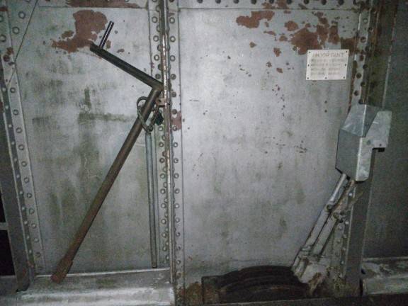
Yes, beside the roadway of the high-level swing bridge near the pivot. I presume the signal-style levers are to lock the span in position.
-
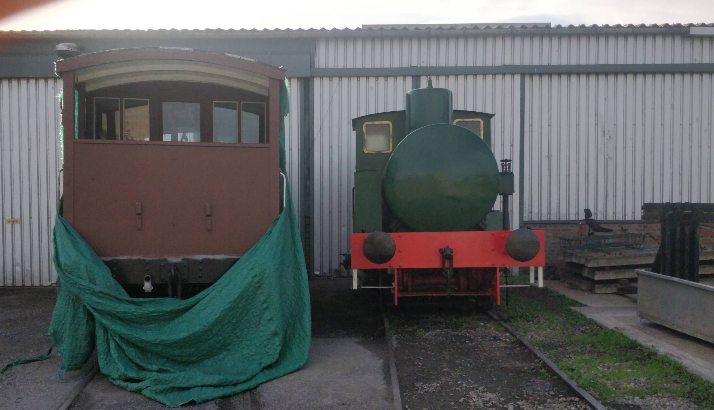
We're still at Sharpness! 😉 The loco is from Castle Meads Power Station at Gloucester, and was in the waterways museum there for a while before being given to the Vale of Berkeley Railway group. https://www.steamlocomotive.info/vlocomotive.cfm?Display=4224 (for the levers I was fishing for a more precise answer, not sure if that's unfair)
-
There are some other interesting things to see around there too. For bonus points, where are these (canal-related) levers?
-
Barnhurst outflow onto the S&W and SU is supposed to be treated. The 2022 data, latest available, says only a few hours of untreated storm overflow over the year but having seen it I'm pretty skeptical. I don't think the normal treatment process can remove all the detergent anyway.
-
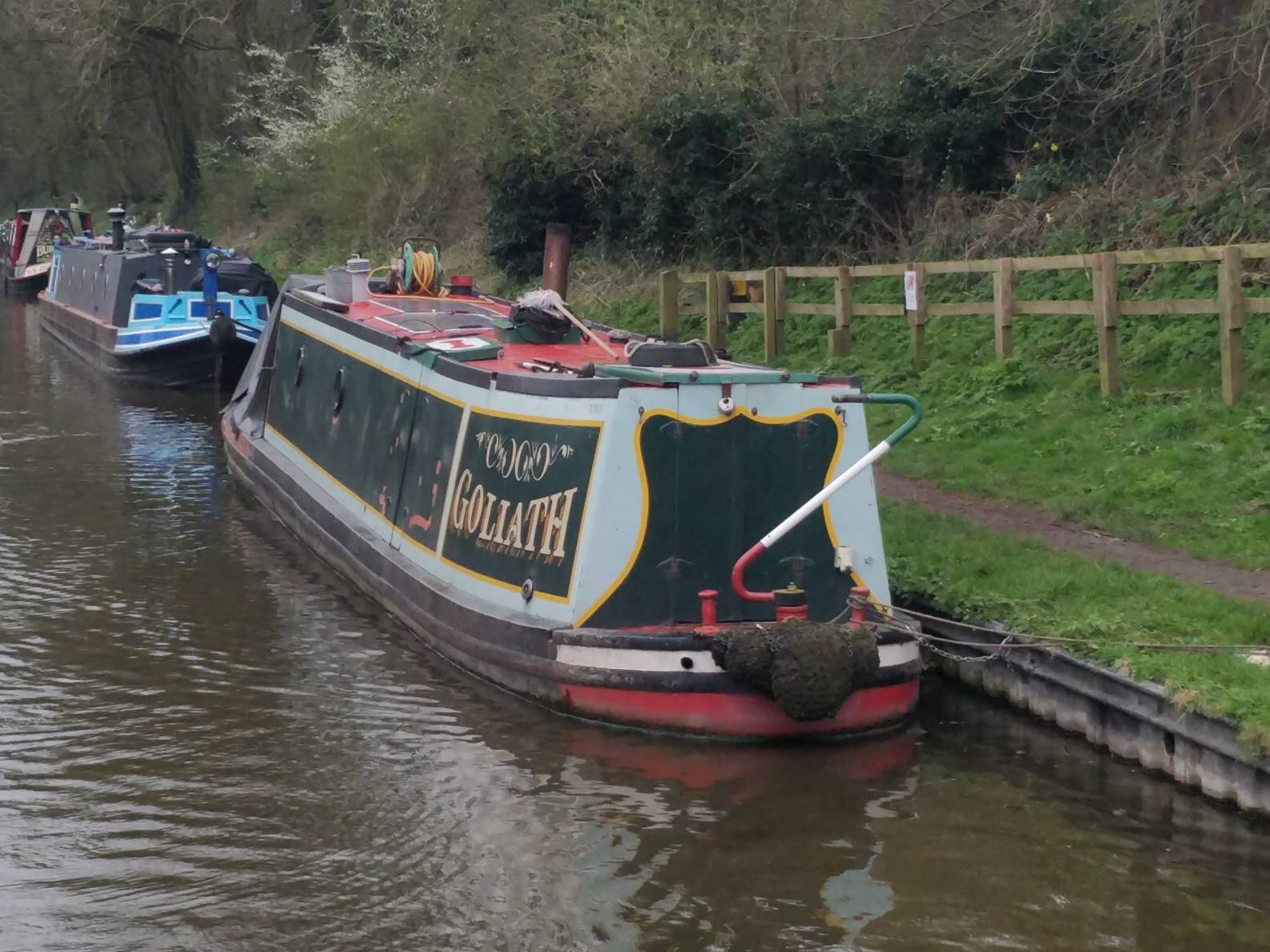
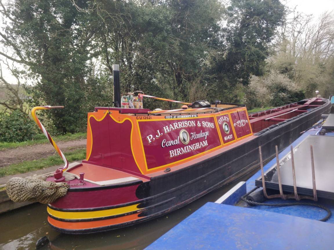
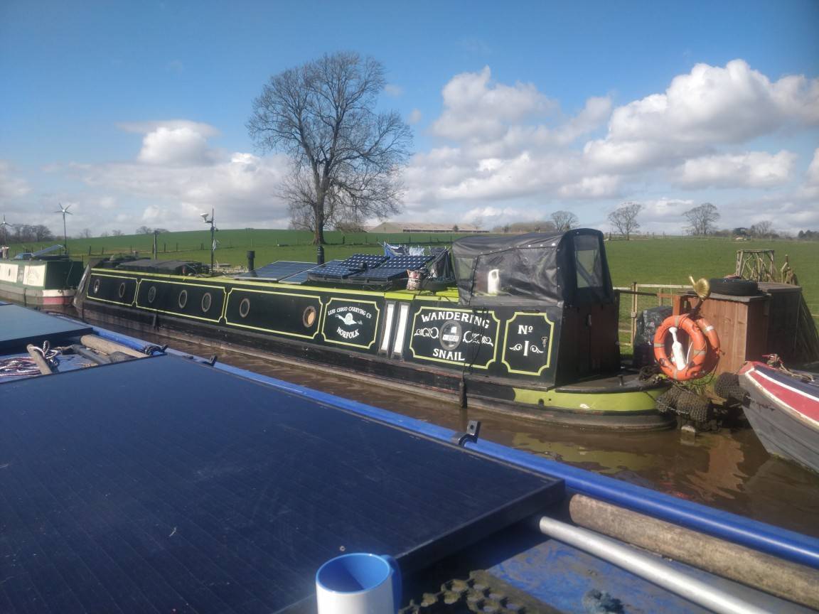
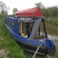
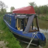
Some boats from the last couple of days.
-
Nope, still very much in evidence at Wheaton Aston last year. With the recent heavy rain, the colour and smell at the moment are quite interesting... CRT had to lower the level at Rotton Park quite a bit in January (IIRC) due to a problem with the spillway. I'm surprised that doesn't show up in the BCN numbers.
-
7 amps at, say, 14V is about 100W. That seems reasonable to me for a 150W panel in direct sunlight. There's a significant temperature coefficient for solar panels, so I actually see higher peak outputs early in the year than mid-summer, although my often-angled panels will benefit less from the sun being high in the sky than your flat one. Solar panels get very hot in direct summer sun - up to 75°C or so, losing about 1% of output for every 3° of temperature per the datasheet for mine. That's more than enough to outweigh the more favourable angle. Of course total output is still much higher in the summer thanks to longer days and generally better weather.