Chris Lowe
-
Posts
2,291 -
Joined
-
Last visited
Content Type
Profiles
Forums
Events
Gallery
Blogs
Store
Everything posted by Chris Lowe
-
 Did they call International Rescue. https://i.imgur.com/hxlAesv.mp4
 -
With the rind still on?
-
https://x.com/Canal_Network/status/1802044569191624795 How long before it's blamed on CRT
-
This post cannot be displayed because it is in a forum which requires at least 10 posts to view.
-
Beaver sightings in Wolverhampton canal
Chris Lowe replied to Stroudwater1's topic in Waterways News & Press
If they build a dam it'll become a nature reserve with no boats. -
This place?

-
No need to feel guilty as neither of us knew what each other looked like.
-
When are you back at Welford, for a pint in the pub?
-
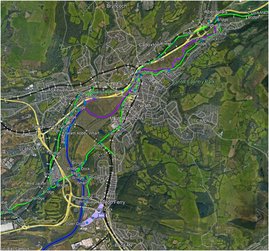
Google Earth Canal & River Map. (Canalmaponline)
Chris Lowe replied to Chris Lowe's topic in History & Heritage
I was looking on the wrong place further down stream at Barcombe Mills, the locks on the river have been derelict for a very long time, but there is a society. These must be what you meant Tony. Short distance down steam here's the old lock.
-
Google Earth Canal & River Map. (Canalmaponline)
Chris Lowe replied to Chris Lowe's topic in History & Heritage
Plenty of boats in the River at Lewis, but I couldn't any at Barcombe altough the old lock cut is very visible & there are jetties with boats at Malling farm past Lewis. -
Google Earth Canal & River Map. (Canalmaponline)
Chris Lowe replied to Chris Lowe's topic in History & Heritage
It is difficult, but looking on Google Earth for moored boats is a good start. -
Google Earth Canal & River Map. (Canalmaponline)
Chris Lowe replied to Chris Lowe's topic in History & Heritage
Thanks Patrick Updating the river navigations is next & I've already started, quite a few markers I haven't added text to yet.
-
Google Earth Canal & River Map. (Canalmaponline)
Chris Lowe replied to Chris Lowe's topic in History & Heritage
The Welsh update is now live https://www.RailMapOnline.com/Canals.php?lat=51.78694&lng=-3.48209&zoom=10.0 -
Google Earth Canal & River Map. (Canalmaponline)
Chris Lowe replied to Chris Lowe's topic in History & Heritage
As I'm about to update the river navigations, does anyone have a good suggestion to start. -
Google Earth Canal & River Map. (Canalmaponline)
Chris Lowe replied to Chris Lowe's topic in History & Heritage
Just sent the big update for the Welsh canals, hopefully Matthew who owns the website will update quickly. I'm going to start again now as I now need to update all the river navigations. -
Our bow doors where closed, we had quite pool in the bow deck well, I jumped in & lifted the deck boards so that it didn't get into the cabin, goodness that must have been in the early eighties.
-
Many years since I worked that particular Caldon lock but we did it the normal way, my mates who where newbies nearly sunk the boat while I worked the lock, they got too close to the middle gates and the gate leaks filled the bow deck well, fortunately SwanLines bilge pumps where up to the job.
-
There are loads of suppliers & manufacturers, we used several when I worked at Niftylift.
-
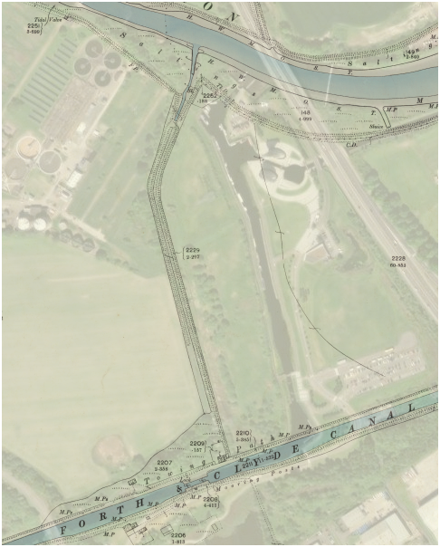
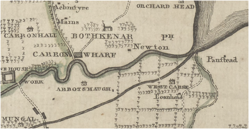
Yes the canal is labelled as old canal.
-
This one is right next to the new one.
-
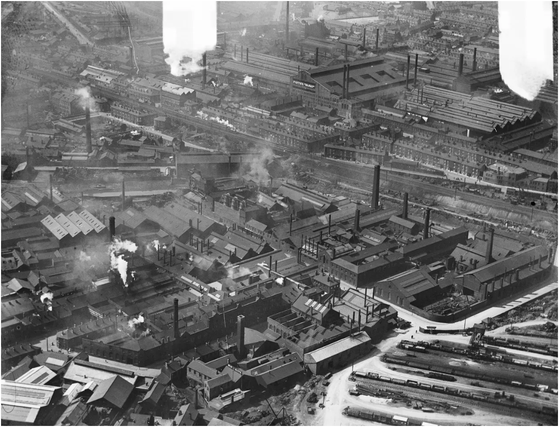
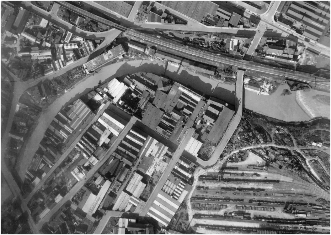
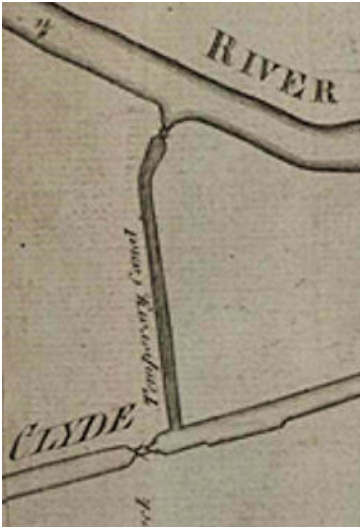
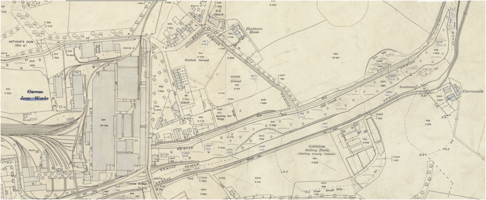
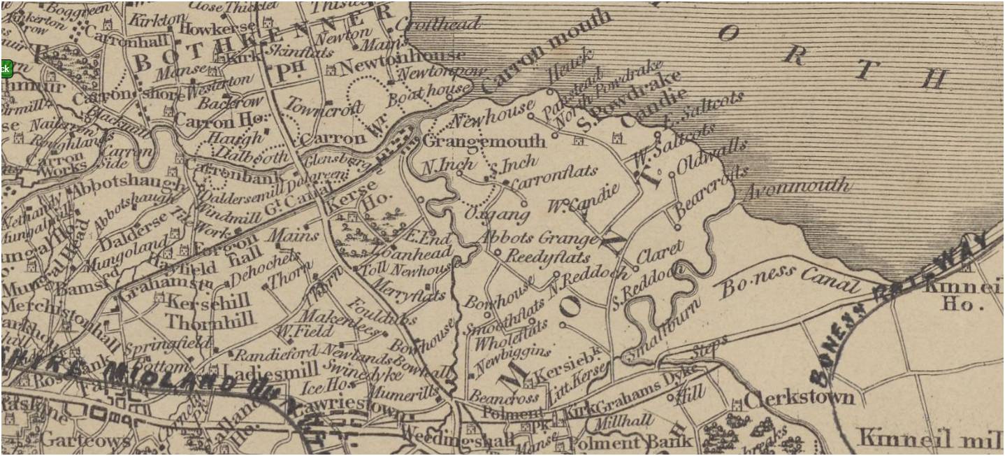
Nice detailed map of the iron works. I wonder why when they built the new Carron cut connection from the Forth & Clyde to the river Carron they didn't just reinstate the original Carron cut? Some interesting old maps of the area online, haven't found one yet that shows the Carron cut actually in use. Not seen the Forth & Clyde called the Great Canal before, & this one even shows the unfinished Bo'ness canal.
-
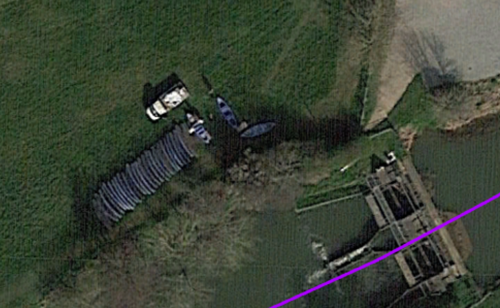
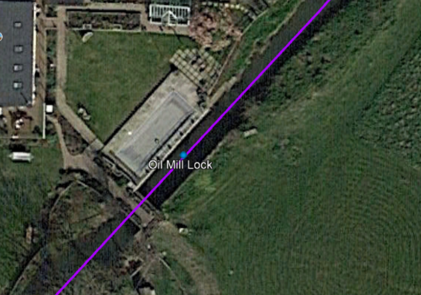
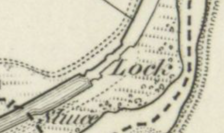
I wonder if they changed the design of the lock at some point, for the OS to show it with 3 set of gate recesses.
-
it does appear to have gates in the middle.
-
Maybe, but 3 sets of gate recesses. Not much on Canmore about it. A search shows that a photo of the lock from the dig in 1994 is in the Callender collection. From Secret Scotland. Carron Canal The canal ran east from the Carron Ironworks parallel to the River Carron for a distance of about half a mile where it joined the river through a lock. This was at the highest navigable point on the river at the time. About halfway along the canal a small spur ran north west to a brickworks. RCAHMS dates the construction at 1781. This came from an inscription uncovered during an archaeological dig in the 1990s prior to a housing development on the site. It is believed that this construction re-used stone from a nearby beehive-shaped Roman monument called 'Arthur's O'On' (Arthur's Oven), thereby destroying it. Drawings of this structure, believed to be a victory monument, appeared in the 1743 book "The Lands and Lairds of Dunipace". The date of the canal's abandonment is not known at this time but both are on maps dating to 1864.
-
The way it is drawn the river lock looks to be a double.