Michael Donning
-
Posts
36 -
Joined
-
Last visited
Content Type
Profiles
Forums
Events
Gallery
Blogs
Store
Everything posted by Michael Donning
-
I programmed the equivalent of a satnav for canal boats
Michael Donning replied to Michael Donning's topic in Holidays Afloat
Hi! https://canalcompass.de is a so called "PWA". You navigate with a browser to the website ( https://canalcompass.de ) and install it. On Apple Devices (iPhone & iPad): When you've opened the web site in Safari, then press the "Share Button". Then select "Add To Home Screen". On Android Devices: When you visit the web site and the PWA is not yet installed, there should be an install prompt popping up. Alternatively you can select "add to Home Screen" from the "..." Menu in chrome. (If the App is already installed you'll find "Open Canal Compass" instead in that menu) On Windows Computers: The Installation is possible from Chrome and Edge Browsers. (not Firefox) But you can also use the Website directly. Here's some more detailed instructions on a completely unrelated website: https://www.civicgov.civicplus.help/hc/en-us/articles/22341794253335-Install-a-Progressive-Web-Application-PWA -
Sorry, that I didn't do any updates on the project in the recent years. I just wanted to say that the project isn't abandoned. (And recently, it may be that my canal "sat-nav" project consumed some time. see:
-
I programmed the equivalent of a satnav for canal boats
Michael Donning replied to Michael Donning's topic in Holidays Afloat
Thank you, I'll be happy to hear your feedback. GitHub isn't planned right now. But some browsers developer consoles allow a bit of insight in the code (although "minified") and especially the locally stored data -
I programmed the equivalent of a satnav for canal boats
Michael Donning replied to Michael Donning's topic in Holidays Afloat
Yes, there are guides/folders with information aleady on the boat and naturally, we also brought our own printed Nicholson guide. But usually, we got our phones anyway in reach (except when it is raining) to catch some blurry photographs of the local wildlife:
-
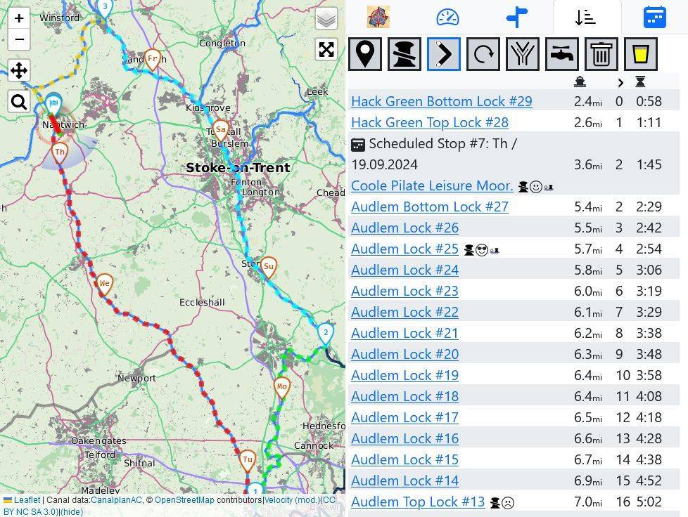
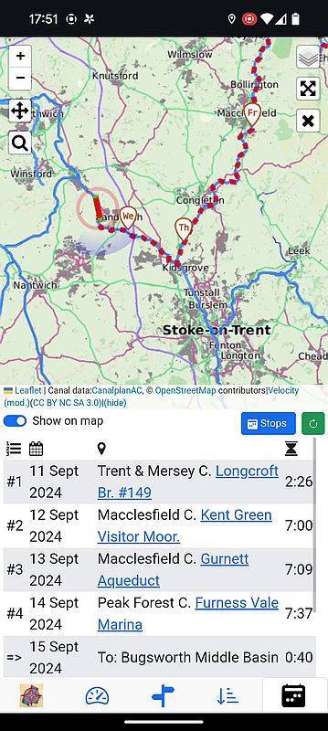
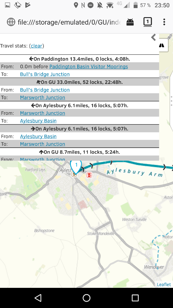
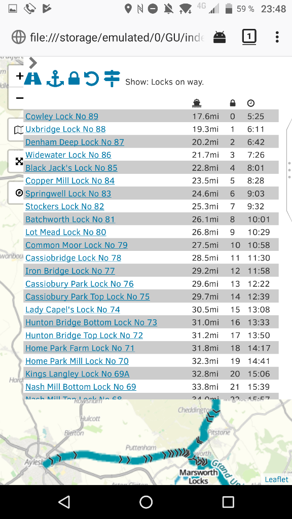
Hi all, I did some kind of travel time scheduling tool for our canal holidays as a private project. I know that this is a bit overkill but I simply couldn't resist. It is a website which can be installed as an app or more exactly a "PWA". It should work on most devices like mobile phones, tablets or PCs (the latter usually have no GPS though). That app/site is created from the perspective of a holiday hireboater. Questions like: How long it is until the next lock? Should we pull the kids/lock crew away from their phones already? Is enough time left on our schedule to do a little detour? And so on... That's the reason why I posted in this subforum. The canal data is from CanalPlanAC https://canalplan.org.uk. But due to caching on my side it may be up to one year old (I wanted to keep their server load low). Please don't take the app too serious. But if you want to play around with some software, there you go: https://canalcompass.de (I am from Germany, therefore the german domain ".de" which is cheaper for me.) There's also a youtube video: https://youtu.be/mHV-EDqPgpI And two screenshots:
-
The Four Counties Ring – Interactive map
Michael Donning replied to David Floyd's topic in Holidays Afloat
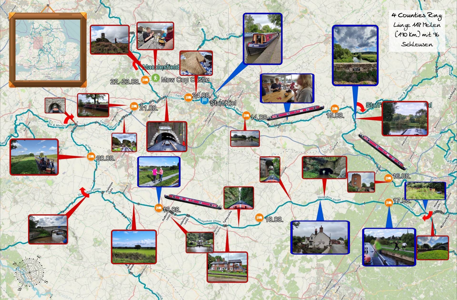
Hi, for the final step of combining photos with the map I used the CEWE Photobook Software. I used the german version but I see that CEWE also has an UK site to download the software from. In this case the map was imported as background image and the photos were place with map symbol masks. You can find/download more masks inside the CEWE software. The main purpose of the software is creating/ordering photobooks therefore there is no real export functionality. I simply did a screenshot to export the page (i twitched my nvidia display driver to have 4 times the resolution of the monitor beforehand to have a higher screenshot resolution). The software also comes with an own function to create travel maps which comes at an extra fee when ordering a photobook. I didn't use that. There is some other software which I used to produce the map image background. All mentioned software is freely available (yes, even google earth pro). google my maps: Is a Google web site which allows to create user specific maps, add own tracks and icons and also share this map with others (i.e. during travel) canalplanAC: Can be used for route planning, routes can be exported in GPX or KML format for use in google my maps or Google Earth Pro or even the photobook map function. Google Earth Pro: Can import GPX and KML files (i.e. exported from google my maps). I used this tool to rotate the map and include a custom background map/KML. Mobile Atlas Creator/MOBAC: An import/export tool for tiled maps. I combined the tiles from the "classic" CRT map and some open source map to export as KML (in this case basically a big image file with coordinates) for use in Google Earth Pro. Defining own "map sources" in MOBAC is non-trivial though.- 13 replies
-
- 1
-

-
- four counties ring
- trent & mersey
- (and 3 more)
-
The Four Counties Ring – Interactive map
Michael Donning replied to David Floyd's topic in Holidays Afloat
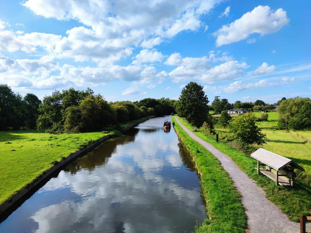
We did the 4 Counties last year in the summer holidays. We hired the boat for 11 days and had enough time to do a little detour in the Macclesfield canal. The only thing which seemd to lack a bit of "flexibility" in the route planning was the Harecastle Tunnel. Which finally wasn't a problem. We arrived at the northern end in the morning and just had enough time for the briefing and through we went. As this is the "Holidays Afloat" group I feel obliged to add the map page from our Photobook ofthe holidays: 😉
-
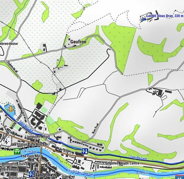
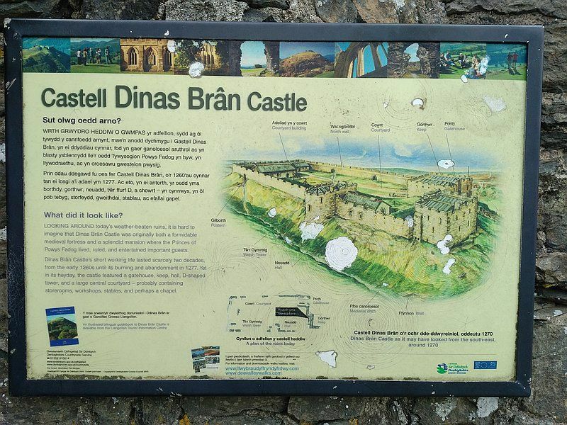
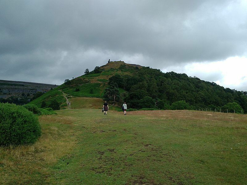
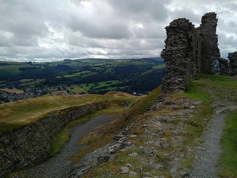
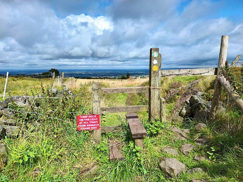
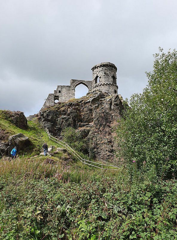
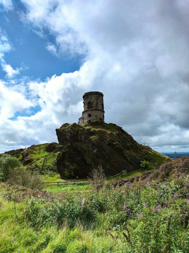
Llangollen has some nice little destinations. I.E. there's a steam train running or you could walk to the horseshoe falls and do a picknick. We very much enjoyed the short (but upwards) hike to Castell Dinas Brân. On "the other end" of the Llangollen Canal. There's Snugburys Ice Cream near Nantwich. Well reachable from the Llangollen Canal over the fields (see dashed lines on the map). Nothing spectacular, but when you travel with small (or old) kids.... Sorry, I already mentioned this recently in a another post: From the "southern end" of the Macclesfield Canal you can reach the "folly" Mow Cop. Nice rock formations and great views from the hill:
-
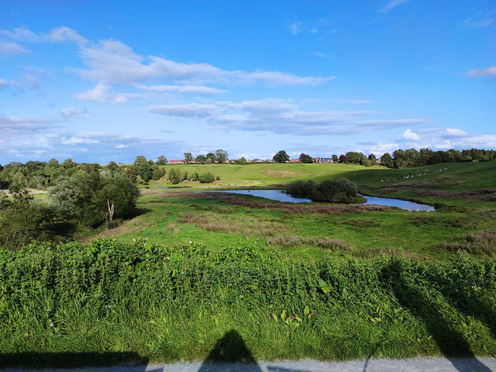
We did the 4 Counties on our hireboat holidays last summer (2023). We started in Stoke on Trent and went clockwise. We had hired the boat for 11 days and arrived at the harecastle tunnel early and did a small detour on the Macclesfield Canal to stop one day on which we did a hike on Mow Cop. If you plan on going on the Caldon Canal you might want to consider going clockwise as well. In that case you will arrive at the junction after having gone through the harecastle and are more on the safe side with your schedule. Another option might be going further on the wide part of the Shroppie. The section to Beeston ist IMHO beautiful and Beeston Castle seems to be a worthwhile destination for a hike. Personally, I would refrain from going further on the canal to Chester as you said you would rather skip bigger towns. Also there's quite a long section of permanent moorings to pass by in tickover before getting to Chester which can be slightly "boring". Or you could also go on the Llangollen canal for a smaller bit until i.e. Wrenbury or Whitchurch. The llangollen is very beautiful & rural in the "lower parts" and you would be able to do some liftbridges. Mooring: Our family preferred moorings with nice views and not too many boats around. Our nicest moorings were on the Shroppie and the Middlewich Branch. Although we often chose locations with a wide underwater "shroppie shelf" where we had to use the plank. When mooring in those places it is also a good idea to lower the fenders (those "rubber sausages" you find on hireboats) below the water level to dampen the "impact" between the underwater shelf and the boat. Here are three of our "shelf" moorings: Brewood. Nice little village which is worth a walk. This was one of the widest shelf. We had to put the bow "on the shelf" first to let the crew on land. (Or you do that under the bridge from which I took the photo). Maybe a bit too fiddly if you're only two on the boat. Audlem, near the crossing over the River Weaver. Wonderful view: (and also a nice little village) (Middlewich Branch) Church Minshull Visitor Moorings. Some of the moorings are also without the "shelf". There's a pub not too far away: And a view of the "folly" on Mow Cop (reachable from the Macclesfield Canal):
-
Best route for a family of newbies please
Michael Donning replied to BeaBirch23's topic in New to Boating?
Chas Hardern is a good choice IMHO. We hired a boat from Chas in the summer of 2019. The Shroppie from Beeston to the middlewidch Branc is already very nice. There's a castle at Beeston which you might want to plan in before or after your hire. The first part of the llangollen is very rural. This is beautiful but you might have to do the extra mile for groceries. 😉 Although from a stop at Lift Bridge 19 (Wrenbury Church) there was a nice foot path over the church yard to a small village store in Wrenbury. In Ellesmere there's a TESCO directly at the canal arm. (Might want to avoid going into the small arm in summer holidays.) Don't worry to get a mooring spot in Llangollen. Try at the basin first and in the unlikely event there's no space then turn around an get a place at the towpath. "Smaller" walks from the mooring are up to the Dinas Bran castle ruins which my kids enjoyed very much or up the remaining llangollen to horseshoe falls. (On the way, you might step down to the rocks of the river dee if river flow permits.) Anyway, even a shopping tour to ALDI along the river is a beautiful walk in Llangollen. 🙂 In case there are stoppages on the Llangollen then you can consult the people from Chas Hardern. There are plenty of alternatives when starting from Beeston.
-
Macclesfield- & Peak Forest Canal
Michael Donning replied to Michael Donning's topic in Waterways News & Press
Ok, I missed that one. Perhaps because it started in April. (Although there's an update on 26th June) -
Hi, as being only an occasional hireboater, I hope that this post is OK and this closure isn't already posted elsewhere. The company where we hired our boat for this year in August "Black Prince, Stoke-on-Trent" sent me a notice that the Macclesfield Canal and the Peak Forest Canal will be closed from 10th July onwards. Regarding the news from CRT this is the result of the closure of the Bosley- and the Marple lock flights due to water shortage. https://canalrivertrust.org.uk/news-and-views/news/peak-forest-and-macclesfield-canals-update I am a bit surprised though that the stoppage isn't listed on the CRT notices page, yet. And there's still hope (for bad weather): "Water holdings will be monitored carefully throughout the summer and if there is adequate rainfall it will be possible to reopen the canals to full navigation. " ... Sorry I just noticed that the Stoppages Forum would be better suited, if the mods agree, feel free to move this post... Sorry again.
-
Food shopping guide for the Llangollen Canal
Michael Donning replied to Michael Donning's topic in Holidays Afloat
There's a site which archives many sites. In that archive there's still a copy of the firstmateguides site: https://web.archive.org/web/20181102231509/http://firstmateguides.co.uk/ -
We did the trip this summer (but not from Chirk Marina). Llangollen is "right around the corner" from your start point. It'll be around 3h from the marina to Llangollen basin. For me the most "challenging" part was going "upstream" in the chirk tunnel. But you'll only do that on the end of your trip when returning to the marina. The only challenging part on that tunnel also is that you're going unexpectedly slow and that you might notice that your boat is pointing a bit sideways while going straight. You will pass the moorings on Froncysyllte (before the aqueduct) maybe half an hour after you have started. So I doubt that you already want to already moor just then. In Trevor, there are a few (I think 2) moorings to the right just after the footbridge across the Telford Inn (those are not available on friday-saturday I think...). There also a few more (I think 3) moordings when you continue into the Basin passing under Bridge 29W. But be prepared that you'll have to wind back there. Actually we met some boaters who told us that they forgot to turn left to Llangollen after the aqueduct and ended up in the Trevor Basin where they moored right away. For visiting the aqueduct and Trevor/Trefor we moored at bridge 34W on our way back from Llangollen. That is a wonderful place IMHO. It is not the closest mooring the the Aqueduct though. From there you have multiple options to walk to the Aqueduct/Trevor: via the towpath, via a previous railway line (map recommended) or down the hill via a road (passing the "Pont Cysyllte" road bridge). Like many here already said. I don't see any problems when you go to Llangollen first. Just go slow when you're unsure. The slower you go, the faster you can stop.
-
Food shopping guide for the Llangollen Canal
Michael Donning replied to Michael Donning's topic in Holidays Afloat
Much of that information (shops, pubs, etc.) is already available in the Openstreetmap project. I think I remember that the author of the Open Canal Map had some discussion with the OSM guys about the project name (I don't know how it turned out). Anyway it could as well be added separately to the OCM. By the way, I forgot to add the proper disclaimer about my map source. Here it is: Map Data: © OpenStreetMap-Contributors, SRTM | Map display: © OpenTopoMap (CC-BY-SA) -
Food shopping guide for the Llangollen Canal
Michael Donning replied to Michael Donning's topic in Holidays Afloat
We actually fetched some Welsh Oaties from Gerrards bakery (I think) in Llangollen. Butchers weren't a topic as our family of five had only one meat eater which wan't interested in doing his own shopping. But if certain butchers and/or bakeries are recommended here for those locations then I can update the maps at a later time. -
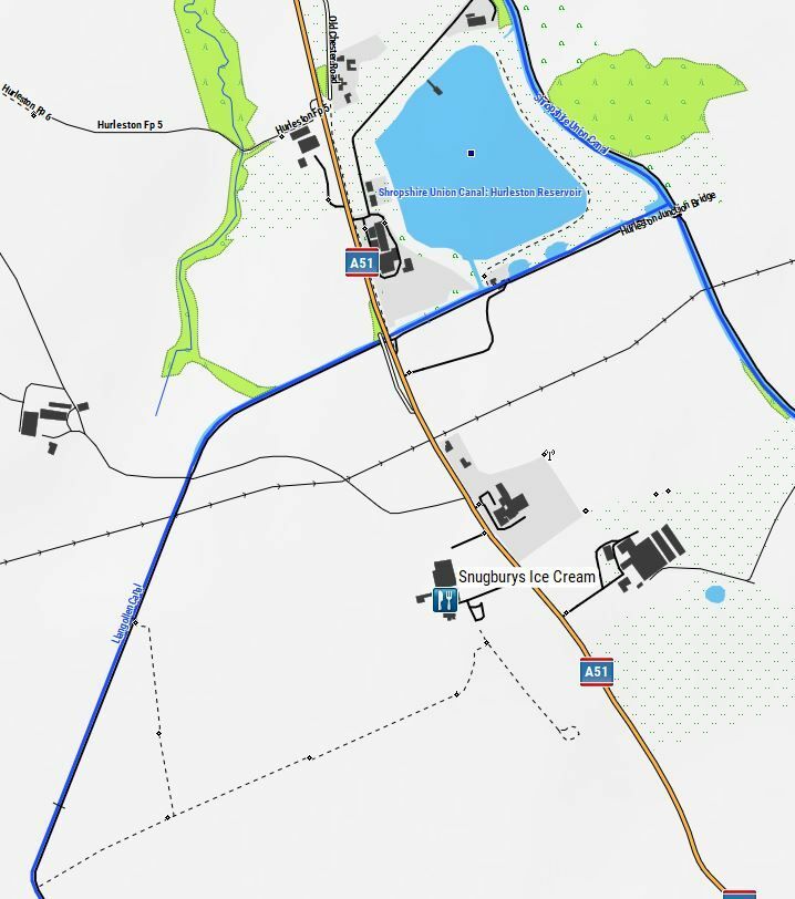
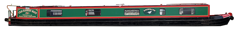
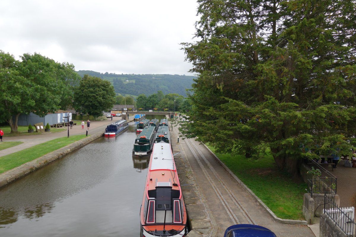
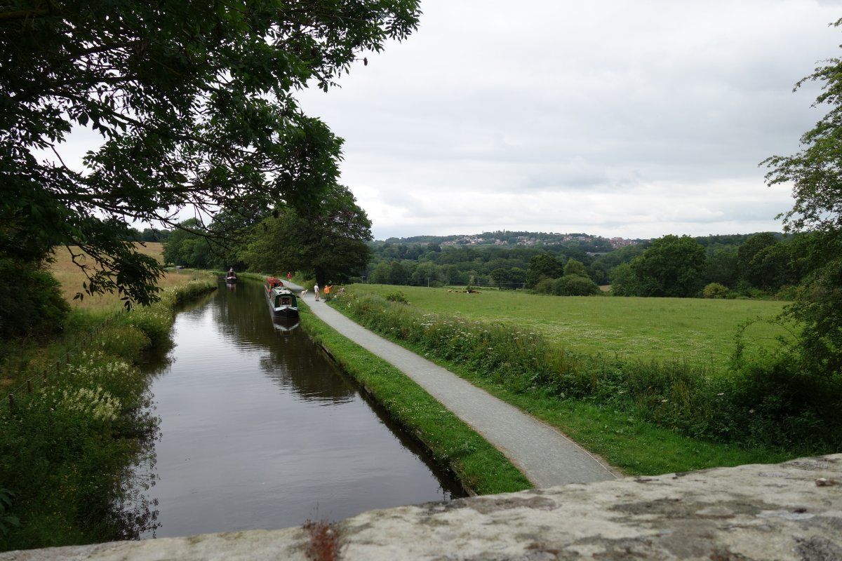
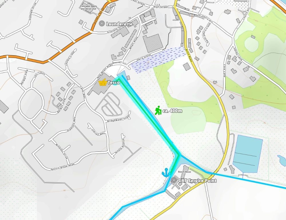
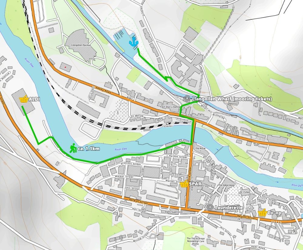
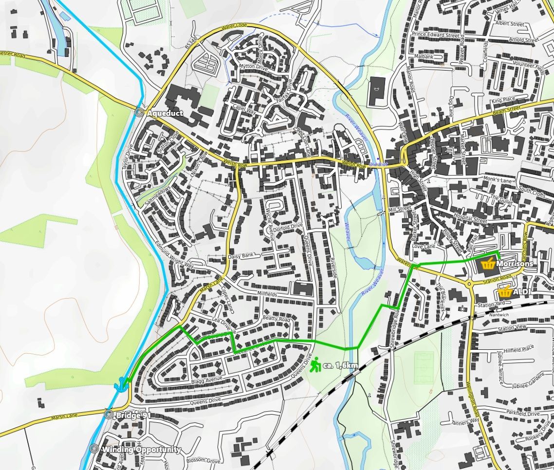
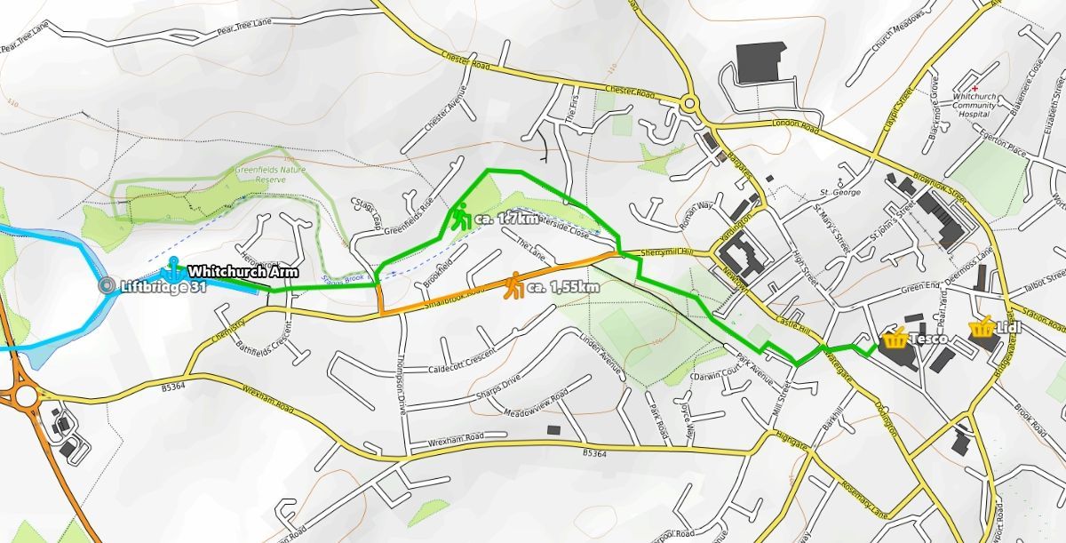
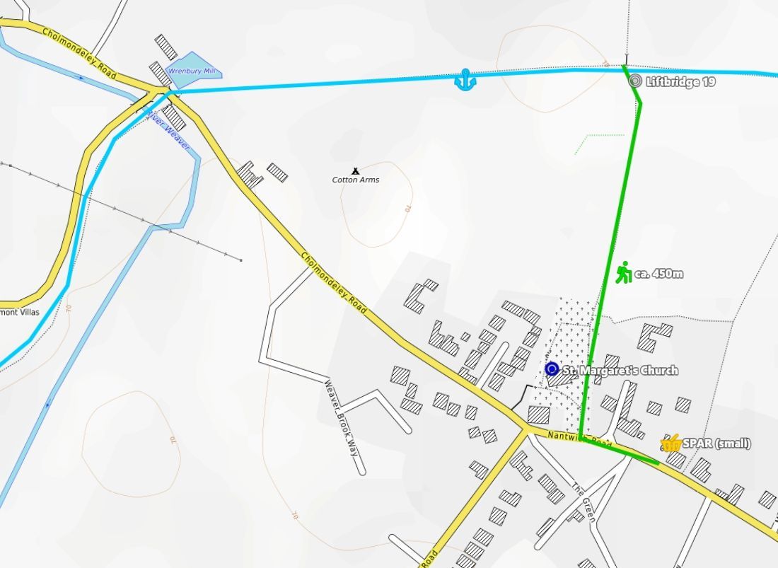
Hi all! We did a 2 weeks hireboat trip in mid July to Llangollen + Chester. One thing that I didn't expect to happen so often was shopping for food. But we had 3 constantly growing teens in the crew which ate us out of boat and home. Another reason may've been also that we arrived (from Germany) by plane. So we did only some essential food shopping before getting afloat on our Snowmane of Chas Hardern Boats. Considering that. I thought that it might be helpful to post some notes and maps on the topic food shopping for other canal visitors. Generally, I propose that you bring a backpack or just any other convient bags (i.e. IKEA bags) for shopping. This depends also on how many hands you have to carry the food (count only one hand for each teen as the other is constantly occupied by the phone). The footpaths which I marked on the maps are often NOT quite suitable for anything with wheels. Nantwich (Shopshire Union Canal): Ok, Nantwich is off topic. But I'll add it anyway as it is quite close to the Hurleston Locks/Llangollen Canal and we actually DID do shopping there. We had to search quite a bit for a mooring spot here. The town seems to be popular. At least in summer and on a saturday. Our walk went through a quiet residential area where we spotted at least 4 cats ? and then through the park along the River Weaver. Wrenbury: There's a SPAR at Wrenbury. Despite its small size you find nearly everything in there. We took the public footpath across a field from liftbridge 19 which (officially) crosses a graveyard. For me, this little village resembles somehow a location of the Midsomer Murders tv series. Whitchurch: You might have to fiddle a bit with the winding holes when coming from north. The footpath follows the former continuation of the Whitchurch Arm. Therefore you avoid any steep climbs. ? Quite a walk but not boring. Ellesmere: You'll find the Tesco right at the end of the Ellesmere Arm. But it can be difficult to find a mooring spot here in the summer. You may consider mooring on the Llangollen outside the Arm. The walk isn't far anyway. I'll skip Chirk. We saw on the map that you could moor up right after the Chirk Tunnel (North side) and walk to a SPAR. But surprisingly we spared this one. Llangollen: In Llangollen, you moor along the canal or in the marina. In any case, if you stay longer than 4 hours then you have to pay a fee of 6£ per day. For this, you'll get water and shore line (if you brought a 16A, "blue", camping type cable, I think) at each mooring spot. I marked the Llangollen Wharf where you can obtain the ticket or ice cream or narrowboat themed towels.... The horse drawn boats also start there. Obviously, there are some shopping opportunities in Llangollen. We found the walk along the river Dee to get to the ALDI actually quite pleasant.
-
This post cannot be displayed because it is in a forum which requires at least 10 posts to view.
-
CanalPlan already allows to set inidividual speeds for different waterway types and locks/swing bridges in the preferences. But using "realistic" average times would nevertheless be interesting. Especially if the "season" and the individual "profile" would be taken into account. This might give a better impression about travel times on very popular canals. (Like the Llangollen in Summer Holidays) including wait times at locks. If inidividual travel times/gps will be collected it might be very important to let the user tell the app if it is mooring (filling up water, eating, etc.) or just standing by for a lock becoming available. In my very limited personal experience as a hireboater on the GU I also found that the default travel times of canalplan ac were a bit optimistic. 3 1/4 mp/h average on a "broad" canal weren't achievable. Our trusty narrowboat became uncomfortable when getting above 3.5/3.6 mph (also the wash then often began to show). And on a big percentage of the canal we had to travel anyway on tickover (which was around 1,5 to 2,0 mph) because of mooring boats or we had to slow down because of bridges/tunnels/narrow bends etc. (I read those speeds using the "OruxMaps" app)
-
I've seen in their forum that CanalPlan can also deliver JSON-Files. But basically, that makes no difference. I still don't see the point of the moving camera. Either you are using the map while on the canal then the camera might just follow the GPS. Or you are mooring/at home then you can manually scroll the map on which the route is displayed. Route planning is tedious to implement. So it is a good idea to query CanalPlan for that as long as you keep the last route stored. Just have an interface to add the waypoints for the route query (from/to maybe stopovers like: From "here" (=GPS) to "winding hole" to "home marina"). The queried data will be sufficient to display nice lists with distances and travel times (with a filter for mooring/winding holes/locks/junctions etc.).
-
The journey time in my little tool is based on the CanalPlan journey time intervals included in their CSV export. Just added up. (People can customize these on the CanalPlan site AFAIR).
-
Sorry, i noticed that my screenshots were far to big. Editing wasn't possible, so here's another post with smaller images:
-
I hacked together a little route planner for our journey last year. It was basically a web site which ran locally on android (within the firefox browser). It used downloaded CSV data from CanalPlanAC (converted to JSON). The "logic" was done in Javascript using the "Leaflet" library and some previoisly downloaded map tiles. If it is of any use I can pack the thing together and provide it to the developer. (in its current form it was basically limited to the GU and some "sidearms")
-
Thank you, Paul. I'll try the directional stability force (might take a time). But I fear that it will just interfere in a bad way with my lift/draft force model. I am aware that the latter is just a very rough approximation to the real thing. The implementation of propwalk is planned. Bank effect, not planned, yet. By the way: I've read that the Coandă-effect is one of the factors which is responsible for bowthrusters becoming pretty much useless on speeds above 5kts (= ca. 5.8mph). But narrowboats don't travel at this speed (at least on canals).
-
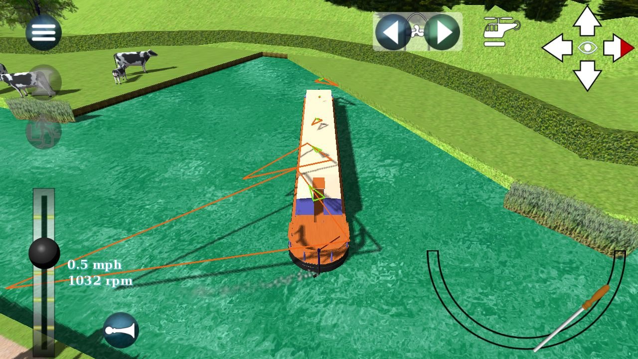
Yes, I use a (quite limited) physics model in the game. There's a basic phyics engine which handles weight/gravity, inertia and forces. On top of that I add a simple 4-area buoyancy calculation and a multi-point approximated lift/draft calculation. Multi-point because opposed to an aircraft wing profile a narrowboat often moves in different directions on different positions of the boat. My much simplified model therefore wouldn't cover the effect of speed on the bowthruster. For now, I just degrade the applied force depending on the forward speed... and I added an overheating turn-off after 10secs of use. The attached image shows the draft/lift vectors of my model while turning.