

Scholar Gypsy
-
Posts
5,054 -
Joined
-
Last visited
-
Days Won
2
Content Type
Profiles
Forums
Events
Gallery
Blogs
Store
Posts posted by Scholar Gypsy
-
-
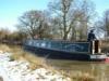
I am interested in understanding the purpose of engine room vents that are below the side deck. You can see some on this boat, blocked off with gaffer tape., just underneath my head (I am sitting on the cabin roof). I can think of three possible reasons:
1) Engine cooling, on an air cooled engine. Quite rare. Obviously not a good idea to block them up
2) Engine space cooling, on a water cooled engine. I would have thought should not be necessary, if you have an adequate keel tank. Not safety critical?
3) Air supply to the engine. A 2 litre engine running at 1500 rpm needs 1500 litres of air (1.5 cubic metres) a minute. If the boatbuilder was a bit obsessive about soundproofing then you need to add a way to let air in. If such vents are sealed up then one may need to lift a floorboard or take similar action to let the air in and allow the engine to breathe.
Anything else I have missed? I am just reviewing the guidance St Pancras Cruising Club gives to boaters visiting the tideway. Different guidance applies to composting toilets, fore deck scuppers and gas locker drains.

-
This is a more than unusually nerdy blog. I do rather enjoy having three journeys on the same map!
https://scholargypsy.org.uk/2025/06/30/st-pancras-cruising-club-annual-tideway-cruise/
-
31 minutes ago, Harbroe said:
Those were the sort of timings I was aiming at, despite being told repeatedly that it's a 3.5 hour voyage. I forgot we were also delayed by being asked to await for an upcoming trip boat into Teddington Barge Lock, and the rather steam driven way the bottom sluices are currently operated. It looks like a Black and Decker on steroids, mounted on a support; hardly the easy button press we're used to! And yes, the commercial traffic plus a Police boat at speed were responsible for the rough water, though the wind was a contributor.
What software are you using to provide such a detailed set of timings, please?The Teddington arrangement is indeed high power electric drills. That part of the hydraulics is not working. Fortunately the gate rams are!
I use Mxmariner on my mobile phone, which is linked to a set of nautical charts. The track facility produces a GPX file of waypoints (time, lat and long) which can be used to produce a map in GoogleMaps. This is quite handy eg documenting the rather strange route I tested out at Hungerford bridge (in the blog post).
I have also written an Excel programme (in VBA) that imports the GPX file, and then processes it to produce the output shown. I manually created a simple database of waymarks that I am interested in, with lat and long. The programme finds the waypoint that is closest to each waymark and then outputs the information you see. It can do knots, mph or km/h. The documentation is currently non-existent but it's fairly easy to use, I can email a copy (not this week - I have the SPCC annual cruise to organise!). -
That's good to hear. Others might like to see the timings from my trip from Teddington yesterday, with a group of four boats (so two lockings needed). Given boats go at different speeds, I reckon four hours is my standard time now, leaving Teddington 90 mins before HW (ie 30 mins before HW London Bridge). One pushes the tide a bit between Teddington and Brentford, which takes 90 minutes. HWLB 1030, HW Teddington 1130..
Most of the rough water in Central London is due to the trip boats (and no exposed beaches), I think.
https://scholargypsy.org.uk/2025/06/21/teddington-to-limehouse-june-21st/
-
At the moment CRT are not accepting bookings for Thames Lock Brentford, I think to avoid a logjam building up there. The work on site only starts next Monday, when we should have a better handle on reopening times. It could be several weeks.
If you are going to a specific mooring in Brentford then CRT may agree to let you in.
Teddington is currently operating 0900-1700 (last entry 1630), so picking a tide is a bit tricky. If you are catching an early morning tide, a number of boats are locking out the night before and spending the night on the tidal river on the floating pontoon.
If you can get from Staines to Teddington then the bit to Brentford is straightforward, if you get the timing right.
This page includes a few tips and a photo to help you turn at the correct time when you get to Brentford https://thamescruising.co.uk/?p=36-
 1
1
-
-
On 08/06/2025 at 09:30, pearley said:
And I guess many if us have cruised under this rolling bridge.
Courtesy of Pennine Waterways.
There's a fine set of lift and swing bridges on the River Hull, sadly not used very much nowadays. Photos here. Sadly they wouldn't lift them for us...
https://scholargypsy.org.uk/2021/06/17/rivers-trent-humber-and-hull-2-old-harbour-to-beverley-beck/
-
2 minutes ago, magnetman said:
Not very practical if you miss the locking in window. I have twice arrived too late and used the outer pontoon. IT Was very rough once the tide started coming in again !!
Indeed. An occasion when big squashy fenders, and long mooring lines are needed, or else find a spare buoy to use (there are some quite close). I've seen the swell snap a T stud off a 70 foot boat, when the boat went up while the thing it was tied onto (by a short line) went down.
-
6 minutes ago, magnetman said:
Yes I think the ribs were using it I have seen it before and since the lock office and related CCTV system is now the marina office and nothing to do with the lock it is awkward to police that area. Thats probably why it has been removed.
About ten years ago I recall someone putting a Boat there then left. The CRT called out a contract tug which towed it away as per the signage. Boats not to be left unattended. Actually that was more like 15 years ago and could have been BW.
I think the reason for not leaving unattended vessels there is the ropes may break then it ends up floating about in a navigation channel with high speed vessel operations. Could be a PLA thing.
It's no great loss IMHO. I would always advise narrowboats waiting for the lock to wait out on the tideway. It's much more comfortable than sitting on the pontoon, and also enables the lock keeper to empty the lock faster.
-
1
-
-
7 minutes ago, magnetman said:
I wonder if this is because it was being used inappropriately as a landing. Or maybe it was breaking free. The inner pontoon did start to break away a few years ago and was fixed.
Now that the marina does not take visitors there will be far fewer vessels transiting through the lock so maybe the outer pontoon is surplus to requirements.
I'm not sure. Last time I crewed on a boat (Augyst 2024) there was a rather inconvenient fender attached to it
https://youtu.be/X8ohLxJudSU?si=jScjcf4ENRXoedl8&t=244
-
1 hour ago, Singing Boater said:
Interesting reading - I hope you don't mind but I have messaged you.
No problem! I will reply shortly.
Looking briefly at this thread, I should record that the outer pontoon at Limehouse is not currently in position (it is tied up in the basin!).
-
1
-
-
West India Dock today....
-
4
-
-
- Popular Post
- Popular Post
A rather fun trip from Preston to Tarleton yesterday - one of the first since the link reopened after a gap of about a year!
https://scholargypsy.org.uk/2025/05/03/ribble-link-preston-to-tarleton-part-1-of-2/
-
6
-
I use Foxes every five years for blacking, hull survey and any necessary works (the sink drain failed in 2023); and Ken at Stretham in the gaps for blacking (which is therefore done every 2 1/2 years). Westview at Earith have a good reputation (and good lifting facilities, which I used last year)
-
I try and keep an up to date list of stoppages on here:
https://goba.org.uk/a-guide-for-visitors-to-the-east/-
1
-
-
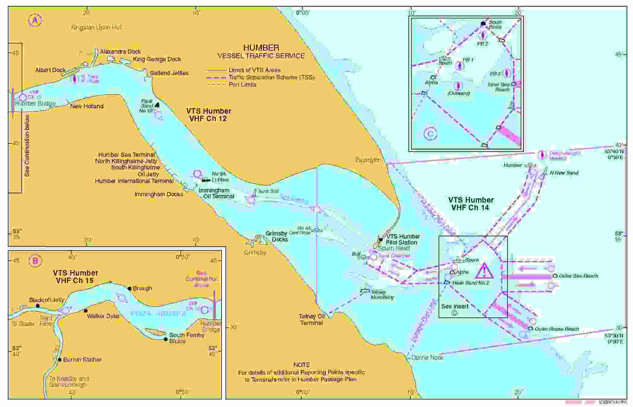
6 minutes ago, Alan de Enfield said:
Humber VTS calling channel is channel 14.
After calling them you should set a dual-watch on both channels 14 and 16.
Channels 15 and 17 are 'low power channels' to avoid overpowering channel 16 which may have a 'long range' mayday in progress and a weak signal strength.
Channel 14 is a normal 'high' power channel (unless you physically select low power)
Were you using a hand held radio ?
These are only 1 watt (low) and 5w (high) so compared with a fixed 25 watt marine VHF with an aerial mounted high up you are going to struggle to get in touch with the VTS.
Thanks, I recollect that the documentation I was looking at (see below) said to call on Ch 15, which indeed didn't work, probably for the reason you state. I was surprised as I had a line of sight to the location - only a few miles away. We didn't see a single other moving boat all day.
Interestingly, on the tidal Thames I now often use a handheld set (5W) but with an external antenna mounted on the roof, and the performance is nearly as good as the standard fixed set arrangement (25W). I can reach VTS from Kew, which is in my experience impossible to do with a normal handheld.
-
20 minutes ago, Alan de Enfield said:
But there is a requirement to keep a listening watch (as shown earlier). We called up ABP to let them know we were on the river, and, if they needed to inform us about traffic, they know who is about.
We called Humber VTS as we approached the Humber bridge, but couldn't get an answer. Weirdly they use a channel on which only low power transmission is allowed ....
-
5 hours ago, MrsM said:
Is the FB group the same one that started life as 'Trentlink'? If so, they are a useful and knowledgeable group. Good luck with your journey, OP.
Yes, and here is the website mentioned above https://trythetrent.wordpress.com/
-
If the journey was in the other direction, then I think this newspaper article would be very relevant. Ditto the advice it contains from HM Coastguard.
https://www.kentonline.co.uk/kent/news/man-sails-round-isle-of-sheppey--a85754/ -
The kink is almost exactly 400m from the east end. It's a good idea not to meet an oncoming boat there.
-
27 minutes ago, PeterScott said:
On this day in 2017
Moving rubbish on the River Thames London
Sorry for pedantry, but the barge in the foreground (GPS ANGLIA?) is construction realated (probably the tideway tunnel). The tug in the distance (REGAIN?) is towing rubbish downstream.
-
 1
1
-
-
I use a bit of silicon grease to hold the new O-rings in place while fitting everything together. PS You did make sure the old rings were removed?
-
1
-
-
-
Here's my (rear) tunnel light in action, a small headlight on a pole. No flash used in this photograph.
As @magnetman described above, I turn the light to point to the right when passing another boat (or to have a look down the side adits in Blisworth tunnel).
-
1
-
-
1 minute ago, Lady M said:
It is vital to have a light on the front of the boat in wide tunnels so that boats coming towards you know where the front of your boat is. If you just have a light on the back, they are likely to move over too late.
Yes, I do have that too. But it is very low power (be seen rather than to see).
-
1
-


.jpg.150b10ab86675f2f4058255219c9a7c4.jpg)


Engine room vents
in Boat Building & Maintenance
Posted
Thank you, I will add that to the list - although any water ingress there won't cause a safety issue, just a slightly fuller tank!
Thank you, that's very helpful. At least one of our club boats does have the vents opening inwards, for this very reason.
Indeed so. I have a copy of the orginal Safety Bulletin and send it to people from time to time!