

Up-Side-Down
Patron-
Posts
1,222 -
Joined
-
Last visited
-
Days Won
2
Content Type
Profiles
Forums
Events
Gallery
Blogs
Store
Posts posted by Up-Side-Down
-
-
Most of the North York Moors catchment area drain via the Derwent which joins the Ouse a long way downstream from York. It's the Yorkshire Dales catchment area that we need to worry about. However I suspect it is raining there too.
Thank you for putting me right on that one Alway Swilby. The BBC forecast for Yorkshire for today:
Yorkshire and Humber
Forecast Summary
Today
A cloudy, wet day for most with rain throughout the day for most parts, often heavy, giving a risk of local flooding. Perhaps drier later in some southern counties. Feeling cold as northeasterly winds strengthen.
Tonight
Rain continuing across the region overnight, often heavy, especially over hills, giving a risk of local flooding in places. Strong northeasterly winds.
-
Been looking at the web cam most of the night and watching the top of the fence post go under,thay seem to be sitting with no list.
On the York Rowing Club webcam site http://www.ycrc.co.uk/webcam - about 1/4 mile upstream from here - the EA state that the river is still rising. Just before midnight the river level was described as being 'Seven steps from the top.' It is currently described as 'Four steps from the top.'
When the river last flooded (little more than a month ago) I can't remember how the height of the water up the No Entry sign equated with 'steps from the top' on the Rowing Club webcam site - afterall I had no reason to! Lets just hope that the river is near its peak as I very much suspect that a water level a few inches below the top of the No Entry sign equates with the nb going over the top of the bankside posts.
-
Little sign of any activity around the boat so far, did you get the impression they were taking it seriously?
I reckon they did take it seriously. It will need waders or an inflatable to reach them now.
Going on the speed that the water rose during the floods last month, the boat is only likely to go over the top of the posts as dawn approaches. However, all the rain that fell in the South West, Midlands, etc is reporting to have headed NE and will be dumping on the Ouse's North York Moors catchment area ever now.
-
I think that this is fair comment and as the OP I have just taken it upon myself to contact the North Yorkshire police force via the non-emergency 101 contact number (not a 999 matter just at the moment methinks) and put them in the picture.Should the emergency services be notified? I can't do this webcam but I do hope you're not going to watch a boat sink.
Once I had explained how I was able to monitor a potential incident on their patch from Strathclyde, in Scotland (not very easy I can tell you) they promised me that they would act. At least we can now sleep easy - although my thoughts are very much with all those out there checking mooring ropes and the like at 3 hourly intervals. The water coming past my boat is just going straight out into the Clyde a few hundred yards away like it always does, weiring over the lock gates day in, day out!!
-
 3
3
-
-
Is it my imagination or is that boat starting to sit down at the front?
I was wondering about that - then thought maybe my imagination was just as unreliable as my memory and eyesight!
I guess that with the cruiser breasted up alongside, when the time comes to take action the narrowboat's options are severely limited.
EA still states that the river is rising and the rowing club now say river 7 steps from the top rather than that it covers 9 steps up from the towpath!
-
apparently this was earlier today, so perhaps the cruiser has moved to the narrowboat side since.
Sorry Matty40s - you're dead right. In post 3 I stated that the cruiser breasted up today so clearly my memory (as well as my eyesight) is failing too! In this light (or lack of it) the webcam clearly shows the nb to be facing downstream and lights appear to be on inside. Too late to rope the boat down, say a post at a time, 100 metres to the safety of the floating pontoon as the water is now very deep bankside. Would that have been a strategy that would have worked had the decision been taken earlier?
-
I'm 99% sure it's facing down stream.
The level looks as if it has stabilised - however North Yorkshire is on 'Amber' alert tonight so even more will be tipped into the Ouse.
'fraid not. 11 steps are reported as being under water on the rowing club webcam (5 @ 10.00 this morning) and on the same site the EA states that the river is still rising. On the King's Staith webcam the tops of the posts are rapidly disappearing under water. Opposite, on Queen's Staith, the National Cirriculum building's ground floor car park is filling up nicely. This is at least the third time (maybe the fourth?) that this scenario has played out in York this year and I feel truly sorry for them. I just hope there's a safe way out for the boats we can see moored at the Staith.
-
from across the river earlier....

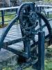
Reckon this is yesterday before the plastic boat breasted up with the nb. Always had my suspicions about fishermen ......... (I assume that's what we're looking at?!?)
-
From what I can see in the picture, if the water rises to the bottom of the ground floor windows of the pub, you should still have a couple of foot of boat below the waterline that can stop you going over the bollards & chains at the edge of the river. However, you will have to make sure you don't come down on the edge of the wall when the water recedes.
Well, if it gets that high then you need a bow rope tied to the top of bridge between the arches.
I can't work out with way the river flows? From this picture it looks like it's flowing from the bridge towards the camera, but on the CCTV images the boats seem to be facing away from the bridge? If it's flowing towards the bridge then you obviously can't use it to tie to.
The river flows towards the webcam so the boats are downstream of the bridge. While the centre cockpit boat on the outside is clearly facing upstream, the narrowboat appears to be facing downstream, although with my dodgy eyesight I can't be entirely sure. Yesterday there was another plastic boat moored, and partially visible on the extreme right hand side of the picture. Without anywhere else much for it to safely go, I would imagine it's just moved up a tad out of shot.
Are there people on the boat still?
Just as it was going dark you could clearly see through the cabin windows that the lights were on in the narrowboat. Prior to that there had been a lot of activity at both the bow and the stern - although I'm still not entirely sure which way round it is moored.
-
I really feel we will see another boat lost, the last floods, as upside down said, came above the white line on the no entry sign.
There is another 50-70mm of rain forecast overnight and into tommorow for the area.
I would also think that the anchor method, if it held, might be the only answer.
but when trees like this one are coming down....
as a complete other view, having seen what happened last time, and knowing what is coming, I think I would allow the boat to cross the railings and tie up to the pub, and get it craned back in once the water has receded.
Coincidentally that's what happened 25 years ago at the opposite side of the river on Queen's Staith. A link to the video of the crane recovery can be found about a third of the way down Richard's blog on the post for 5th October http://canal.travel/node?page=2
-
This is the view in drier times. During floods earlier this year the water level was just below the Kings Head's ground floor window lintols. Search for Kings Staith York on Flickr to see what can happen to the Ouse at this location when the river gets really naughty.
You can clearly see what the two boats are up against - literally and metaphorically!
-
I suppose that those 'riverside bollards' are underwater then? Will they secure ropes that are pulling up, and away? And if it is a foot deep, adjusting the ropes is going to be a fiddeling in the dark job, not good.
The owners may want to secure the boatpole and gang plank down the side of the boat, if possible, to avoid going over the bank.
Sorry Luctor et emergo - I meant those 'sticky up to waist height thingys' designed to stop people/cars going over the edge into the river. Not what you or I would moor a boat to at ground level!
It's when you do a B followed by a bracket
it automatically inserts one.Back OT - I think I would be reluctant to stay on the boat(s) to be honest in that location.
If they have to stay and the the NB is tied to the bollards and the level continues to rise they risk the same situation that happened a few week s ago unless they can keep slackening the lines, the problem then is that they couls float over and clear the fence and be floated onto the wharf next to the pub! _ I'm simply not sure how you could prevent that from happening.
Thanks for the info about the smiley. I'll remember that in future!
It was thoughts about what you describe as floating over the fence and into the bar of the pub that prompted my question. The words 'devil' 'deep' 'sea' and 'blue' came into my mind!
-
Another way to monitor the situation is via the York Rowing Club webcam http://www.ycrc.co.uk/webcam which also includes the EA's assessment of the river level - in this case that the river is still rising.
It has steadily gone up at one step an hour (at Museum Gardens) since 10.00 this morning
-
That looks bad. Is it at all possible to get to the boats (waders, dingy?)?
At the moment there is no problem as the water on the staith is probably less than 1ft deep. There are people on board and the centre cockpit boat has only breasted up sometime this morning.
-
The view from the webcam overlooking Kings Staith in York http://www.farsondig...orth/Ouse/York/ shows a potentially 'difficult' situation developing.
Given that:
a) The river is still rising - pretty rapidly
b ) During the last floods, about a month ago when a narrowboat sank just upstream at Museum Gardens, the water level rose on Kings Staith to 3" below the top of the No Entry sign visible in the foreground
c) The boats are currently moored to the riverside bollards
what would the experienced boaters amongst the members of the forum do now? I for one would like to learn from this situation in order to make the right decisions in a future, similar predicament.
(don't know where the 'emoticons' come from - but it don't belong here and I don't know how to banish it - sorry)
-
Waterway rescue company adopts new recovery strategy! (and still not a life jacket in sight!)
Many thanks for all the helpful suggestions in relation to my first abortive attempt - I'd tried hosting the image on Flickr and failed.
The GALLERY was the last desperate attempt in view of the advice in previous image posting threads. The giveaway (and my final success) was the reference to the missing jpg suffix.
What I've always loved about this forum, as a visiting guest, is the way members always rally round to offer help, support and advice. My thanks again.
Please could a moderator help a newbie out by combining the 2 threads that I've now started?
-
Waterway rescue company adopts a new recovery strategy!
Looks like its a trip to the GALLERY 'til I get this photo posting business cracked!


 it automatically inserts one.

Potential Drama Unfolding
in General Boating
Posted · Edited by Theo
Remove unnecessary vitriol.
The level appears to be stabilizing from the webcam pictures and this would seem to be backed up by the EA Viking recorder close to this Staith: http://www.environme...stationId=8208.
My concern now is over the rain currently falling and the wet forecast over the next 24hrs. Are there any options still open to the owners of these two boats if the water level does continue to rise?
http://www.environme...?stationId=8208 = complete link (which is also in post 37 if this fails to show properly again)