


Ian Mac
-
Posts
635 -
Joined
-
Last visited
Content Type
Profiles
Forums
Events
Gallery
Blogs
Store
Posts posted by Ian Mac
-
-
There were cranes on the Ashton near Copperas Lane, near Meadow St and also on the Peak at Hyde, these will be the sort of style you require. There are pictures of all three floating around on the interweb.
-
This could get really interesting!
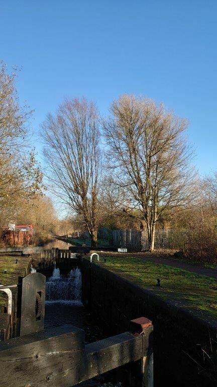
Box trunks are a common form of providing a means for draining a canal. As Pluto has already shown they are standard on the L&L. And also as shown above the Rochdale also uses them.
As does the HVNC and the Chesterfield.
There construction is very simple. A vertical shaft is constructed from a horizontal culvert which runs under the canal below the puddle lining. A elm board is made traditionally these days one may use oppepe. This is placed on top of the vertical shaft and it is then sealed in place with clay which bonds with the puddle clay in the bed of the canal. The board has a chain attached to it and the chain is traditionally hooked onto a hook which is positioned in the wash wall under the water. The site of the hook is marked on the top of the wash wall. On the Rochdale an arrow is used. On the HVNC a roller is provided to which the chain can be attached and the roller has to cross holes in it so a couple of bars can be used to rotate the roller and thus pull the pull up. On the Rochdale winch points were provided by these were deemed to be a trip hazard and that bit of heritage has been got rid off.
On the Ashton, Peak and Macc a different system is used. A culvert leaves the canal horizontally from the bottom of the bed, and normally passes under the towpath. This connects at the far side of the towpath with a vertical chamber about 3ft square. This chamber has a set of stop planks in it and then on the far side of these the culvert continues onwards to the stream/river where the water will be dumped. There is a paddle frame which covers the hole as it leaves the chamber.
The planks as secured with two sets of wedges one set hold the second stop plank down from the top in place and then another pair of wedges secure the top stopplank.
This enable the height of the top plank to be adjusted to the weir level of the canal. The Paddle is normally left in the open position and it is the stop planks which retain the water. The paddle is closed the top plank removed and all the wedges and this enable the planks to bob and be removed then the canal can be drained by opening the paddle. On the Macc these paddles have a triangular spindle and a special windlass. The outlet culvert is sometimes also used as part of the storm weir system.-
 1
1
-
-
4 hours ago, enigmatic said:
A very quiet Piccadilly Basin. Got down this afternoon with Ian's help. Locks were smooth enough although I'd still be doing them now without someone setting them ahead and closing the gates.
Only opened the weed hatch twice today and once yesterday and the worst thing I picked up was a coat so the canal rubbish gods were on my side!
Come on, you have bragging rights now - an easy passage down the Manchester 18 - a relaxed trip in under 4 hrs. A little on the chilly side to start with, but a nice sunny day. Nothing major wrong with the infrastructure, and quite a few things have been improved/mended
")

-
We have become very concerned by the changes in headlights, our own included. We switched to a LED headlight a while ago, so we could better see at night, so the more lumens the better was the principle, and we stuck to a fog light reflector so that we got a wide narrow beam, once the technology allowed us to. We started off using a pair of array LEDS.
However although it is great for night boating we have discovered that it blinds people coming the other way. Two reasons for this 1) is the number of lumens 2) is the colour temperature. This second one is a real problem for two reasons the colour temperature effects the quantity of lumen quite significantly currently, the higher the colour temp the more lumens you can get. However the higher the temp the more dazing the light becomes, due to the way the human eye works. This is why it is getting harder to drive on the roads at night due to dazzle, as more and more headlights become LED ones, and nearly all road Leds are high colour temps.
So we are now in the process of fitting a duel bulb system, where we will have a powerful wide beam and a low power very warm white 2500K bulb and the steerer will be able to switch between them. Hopefully this will mean when we are cycling back towards the boat, we will not cycle into the cut") which is why we started to look into this problem, in the first place. Too many near misses.
which is why we started to look into this problem, in the first place. Too many near misses.
It will also mean if we get dazzled in a tunnel we can totally dazzle back, and maybe the boat coming the other way will get the hint. Till then we will be putting a paper bag over the headlight in tunnels.
-
On 16/10/2021 at 17:11, ditchcrawler said:
Please can I have an E Type in showroom condition complete with insurance, I can afford the road tax myself
I bet you can, as it's free to tax anything built before 1981!!!!!
-
 1
1
-
-
4 hours ago, dmr said:
When you say MCC own the towpath does this apply only to the Rochdale 9 or right up to the Oldham border?
Own is the wrong legal phrase, MCC have a long lease on the Towpath and some other associated lands. C&RT only have a lease for the water walls and everything between them. I am not sure if this holds true at locks, having never seen the legal document, but only heard the problems this arrangement causes. The original lease was for most of the the Manchester 18 with in Manchester from above Great Ancoats lock 82. Not quite sure but maybe from Henry St bridge upwards. This was the 1970 water channeling project done by MCC.
Then in the early 1990's the Council got the lease for the whole of the Manchester 9, this enabled them to bring it up to some sort of working state again. Then the millennium bid happened and Manchester had to make the decision to restore the 18 rather than just saying, they would.
Not sure if they then got the missing bit between 84 and Henry St. and also the pound above lock 78. I know they did not have these bits as we worked upon locks 83 & 82 as volunteers for the WRG NW with RCS with permission from RCC in the late 1970's and early 1980's. The rest had been water channelled, except there was also a piece which was not open to the public from lock 78 to lock 77, this was never water channelled and there was never any public access, till the canal was fully reopened. This pound was used as a reservoir and to supply industry. -
Ownership and rights of the Rochdale canal are complex!
This is my current understand and this is not the full detail.
The Canal is still owned by the RCC and therefore Town Centre Securities, and the Ziff empire.
The canal is then leased from RCC to now C&RT in the main this is a very long lease 777 years I think and counting down, from when ever the original parts started. The back history is complex for this set of leases and involved both councils and The Waterways Trust.
In Manchester it is yet more complex as the original lease was to Manchester City, they in turn have leased just the water part of the canal to now C&RT via TWT.MCC retain the lease for the towpath, and other adjoining lands. RCC still own large tracts of land in Manchester.
I do not know if this split ownership also applies in Calderdale, however I have not heard of this before reading it above, and I was under the impression that the C&RT had full rights except in Manchester City.
The Drydock & Wharf are leased still by Calderdale. however this is offside land and not normally part of a canal anyway, so the TWT and then C&RT would not have taken it unless they had to, as there would be an associated cost.
There is also an ongoing dispute over who owns the bridges in Manchester, particularly the footbridges which replace the low level paths which Manchester installed as part of the water channelling. This dispute is between MCC & C&RT.The offside boundary is complex in places as RCC had leased out land before the restoration, it was unusual for them to sell it outright.
-
Rochdale Canal water supply.
This is an ongoing story, as Pluto says the summit reservoirs were all sold off to Rochdale Council in 1923 for public water supply, with the right to a small supply kept from Chelburn and a larger supply from Hollingworth Lake.
The only supplies to the summit level is from Chelburn and from a small stream at Warland, which enters the canal just above Longless Lock 36 which is the eastern summit lock.
As has been written elsewhere the stream supplies are under threat as the rules on abstraction have recently been changed by the government and all the grandfather rights have been extinguished C&RT are having to make many thousands of applications in an attempt to retain these old rights.
There are also supplies from streams just below lock 44 and above lock 33, and another supply from the Calder below lock 25 lock. There is also a pumped supply again from the Calder below lock 5. The supplies from the Calder are new and therefore already controlled by the EA so can only operate when there is sufficient water in the River Calder.
There is a reasonable feed which enters the canal on the Rochdale level below lock 48 from Hollingworth lake.
Originally there was a pumped feed from Hollingworth lake via a long sough some of which is underground, to the western end of the summit. This was stopped a long time ago, although the Rochdale Canal Company were still inspecting it in the mid 1980's, however the location of the access shafts to the culvert have been lost.
The summit reservoirs and Hollingworth Lake are now the property of United Utilities, the wonders of privatisation. Every now and then UU want to sell the summit reservoirs, especially when the cost of reservoir inspections appears, and there have been no droughts. C&RT will not take them on unless they are fully inspected. Rochdale Council will not let UU just drain them, so there is hope for the future maybe.
C&RT are also looking at the cost of installing a pump back scheme up from Littleborough to the summit, however that will not be cheap.
-
The L&L collapse of the culvert. This is not be be unexpected. Many years ago a culvert collapsed and BW panicked and inspected all the other culverts on the western side. I do not know if the eastern side was also done. The reason for the panic was the style of culvert build was basically a wooden box made of elm, and the elm is now 200 years plus old. There are a lot of these culverts, so the decision was taken that rather than panic and fix them back then, that they would be fixed on fail, as it is very hard to see just how good the wood is still, and therefore if it needs to be replaced. With hindsight this was the correct decision, as they seem to be failing at about 1 every 2 years. The fix is to dig out the old wooden structure and replace it with a concrete pipe. I would predict that this repair will take about 8 weeks, depending on the start date. That will be governed by getting an access agreement to take modern plant in to undertake the job.
-
- Popular Post
- Popular Post
Hi Folks, well as Mark99 has said the planning committee have rejected the planning request.
Thanks for all you late letters, there was mention at the meeting that there were about 50 late letters, not quite sure what these were but it all added to the PAC unanimously vote to refuse planning.Not sure if it now has to go to main council, but it is unlikely to be changed there.
However this in my opinion is not the end of the line, as the applicant will not now just lie down, so we need to remain very vigilant.--cheers and Thanks Ian Mac
-
7
-
 1
1
-
All very interesting. I provide another though - My understanding is that the term Puddle Banks referred to sites which were sources Puddle Clay.
-
On 02/09/2021 at 15:35, Athy said:
I presume that you've copied your list of replies from a Society document, which I'm afraid hasn't been carefully checked.
Assume nothing - it was a list I generated off the top of my head. Interesting that you think its a copy from somewhere, I might be getting things right, well nearly.
I'll be contacting a friend who is a regular presenter on the local station Moorlands Radio to ask if he can mention the situation in his programme.
Thank you the more publicity we can get the better. I am quite fearful that this application will be appealed. I am not sure why the owner is going for planning on this piece as the other pieces he owns would almost certainly get planning, so why do the most difficult one first? -
5 hours ago, Pluto said:
Possibly the best source is the 1888 canal statistics compiled by the government. This is one page. The depth of the canal was usually slightly more than the depth over the sill, as can be seen in the Lancaster Canal specification
What an interesting Document. Does it have the data for the Rochdale HVNC and Ashton canals, oh and the M&BB if so could I have sight of them please.
--
Cheers Ian Mac
-
NOTE . One should get a response to your email. This is a standard reply. It tells you about the public meeting.
I believe that only 3 people can speak for either side and that the C&UCT are one of those, due to speak.So please do not panic, it should all be in hand
The council officers are recommending refusal, however we are taking part in the longer game, in case an appeal is mounted. So please keep sending in those emails of objection.--
Cheers Ian Mac
-
- Popular Post
- Popular Post
It would appear that the application to build over the Uttoxeter canal is now due to be heard by Staffordshire Moorlands District Council Thursday Next 9th September 2021.
We are now into playing a numbers game, in an attempt to stop this greedy development.
The more people that write an additional objection the better, these are refereed to as late representations.please emailed jane.curley@staffsmoorlands.gov.uk about the Bolton Copper works application SMD/2020/0684
A short paragraph stating that you object, is what is required, together with your full postal address.
Pick one of the following rather than writing a long letter.
This is a nationally recognised historic monument which will be destroyed by this proposal.
When restored it will become an import canal holiday route visiting the fine Staffordshire moorlands.
There is a current active team slowly restoring the canal as money become available.
The route is in theory protected from development by the Staffordshire moorlands structure planThe route is protected by the Churnet Valley Masterplan.
The proof that volunteers can restore it is there they have already restored the first lock.
That this restoration will be stopped in its track if the current application goes forwards and therefore you and other will not be bring your tourist money to the area.
This application is being driven by greed, and we do not object to the other land already designated for housing to have housing on it.
The proposed walking route for the towpath will be destroyed.Please get anyone else you know in your immediate circle of friends to write as well, as long as they are over 18 years old.
It does not matter if you have written before. You can send more than one email, about a different point.
It is a number game now!!!!!--
Thanks in advance Ian Mac
-
5
-
By definition, if the boat was going uphill, which I have read it was, then the pound above must have been relatively low and therefore the flow over the top gates relatively low, unless there was another boat coming down the flight at the same time, which I believe there was not. It has to be a low flow otherwise they would not have been able to open the bottom gates, against the flow to gain access to the lock.
All very unfortunate but as everyone keeps on saying you have to be on your toes all the time.
-
I believe that the Boating Reps have set this Facrebook group up so boaters can join if they wish, it is a moderated group so that flame wars, etc can be avoided. I believe Helen is doing a good job of disseminating what is happening at council.
As elected reps there are also Myself and David Williams who are on council on the behalf of the volunteers and @StarUKKiwi is there as the friends choice, she of course no longer has a boat, due to ill health. David Kent is the elected rep for fisheries. There are 2 for the businesses who use C&RT and another for the employees.
Then there are the nominated ones - see the C&RT web site for the full details.
Please remember the main function of a council member, as determined by the government, when it created the charity, and created council members, is not like that of an MP, to act as a representative. A council members main function is to appoint trustees, and monitor them, although we do have connections and the boaters reps are using them, for the good of boaters, as you will have seen if your following Helens reports.--
Cheers Ian Mac
-
3
-
-
Hi All need your help!
Its a relatively easy task.First, some nearly really good news A developer is proposing to restore the 1936 breach above Prestolee Locks at Nob End, Little Lever, Bolton.
Unfortunately the plan is only to restore it for narrow boats, even though the M&BB is a broad waterway, and the new locks in Salford off the Irwell have been created as broad locks :)
I would be good if you could all to write to Bolton Council and object to the restoration plans for the 1936 breach above Prestolee Locks at Nob End Bolton and that the restoration should be to the original gauge of the canal of 14ft 2inches or 4.32m in modern speak.There are two parts which matter to the canal, first is the new bridge to access the Creams site, this is proposed to have a 2m towpath and a 3m channel. The second part is the restoration of the breach its self, where again only a 3m channel is proposed.
I believe we should object to both, on the grounds it will stop wide beam boats reaching Bury when the restoration is completed.One can object online at
with the reference no. is 09775/20
Unfortunately they do not make it very simple!!! One has to create a login.
Go to the link above, put the reference 09775/20 into the simple search box at the bottom, and click search, this should bring up the Planning » Application Summary page for the ERECTION OF 274 DWELLINGS ON TWO SITES
Then click the comments tab, then click login and comment, you have to create a login identity, before you can comment, and that process sends you a verification email - uhhh!
Once you have leapt these hurdles, the site has a timeout, so it is better to create your comment elsewhere and copy and past it in. Oh and you only have 2000 chars to play with! But you can repeat the process if you want more space.
The M&BB Canal Soc think that getting a 3m channel is the best they can get, and want to go with this. I believe otherwise and that we should all push the council, so that Bury is not excluded from getting history wide beams back, because of the short-sightedness of Bolton Council.
The bridge is not a major problem as the designed can be modified I believe with a floating/removable towpath which can be pulled out of the way to allow wide beam boats to get through it, and on to Bury. This should enable the developer to not have to build a huge spanning bridge over the canal, which would cost significantly more, I'm guessing.
The bridge design can be modified so that it does not have a towpath, it would be cheaper to build for the developer and either the developer could provide or C&RT or the M&BB Canal Soc could raise the money for a floating towpath, as the final solution. In the mean time access could be via paths going up to the road from either side., which should be provided so that the local residents have easy access to the canal.
The floating towpath could be constructed of standard narrow canal boat hulls in principle with support legs, a walking deck and hand rails, giving an approximate 2m width of path through the bridge. By definition two narrowboats will fit through a 5m gap!
The termination of the towpath at the bridge abutments would have to be redesigned so that it links to the floating towpath.
Please see the Rochdale Canal passage under the M62 at Castleton, for an example of how this can be done.
The length through the breach can also be re-organized by doing two straight sections of 4.32m min width we really can keep it that tight, and why not? That is what the locks are. This is only another 4ft 8inches on the currently proposed 2.92m channel. Then at the intersection of the two straight lengths a rotating area can be provided which would allow full length maximum beam boats to realign for the other straight section and then carry on. They would not be able to simply sail through, but would need to be guided through as at locks, but they would get through, a slight increase of another 100mm would help but is not totally necessary.
please see brown markup on attached plan.The realignment area can either be at the front (towpath side) or at the back away from the towpath. I personally think at the towpath side is best and a curve can be used. The architects would need to do the detail but its not far away from what is being proposed.
They could gain some of this extra 1.4m by pushing the northern wall back into the bank a little further. By totally removing the old offside wall. They could also shrink the towpath a bit and make the apron that supports it slightly wider, and hey presto we are there.
The area for the twist to realign the boat will be at the back of the breach area and so would not cause significant addition loading on the land slip area, and would need to be approximately another 3.3m wide at the apex of the two offside lines, I calculate.
It is easy to fix and not that much more expensive.
It may also be possible for volunteer labour to help. please see the Granthan canal and the Lichfield canal restorations, I for one would be keen to help.
Its not ideal, however it would work. It means that the costs are not running out of hand, and it's a workable solution for the developer.
Below I have added an image showing roughly how I think a 4.32m channel could be achieved through the breach area, shown in brown.
-
1
-
-
2 hours ago, dmr said:
Last winter we chickened out of going to Salterhebble and turned at Sowerby, I am not convinced that a 71 footer can turn at Salterhebble but I might give it a try this winter, we need a shorter boat to go down with us in case we need towing back.
You can wind easily wind at Salterhebble at the top lock, always good to back into the lock and take a picture and ask where that is. You can also wind a 72ft boat at Dry dock and at the very end of the Halifax Arm.
Enable one to go to the Navigation in Sowerby Bridge moor conviently
-
What I know,
It is suspected that lock 46 has a wooden floor, something relativly common on the older Rochdale locks - those built under the original 1796 act. locks 1- 50 If this is the case it may well have failed spectactuarly like lock 49 had, in which case they may have to do a full replace, they will not know until at the earlest Friday 24July. Either way it will not be a super quick stoppage unfortunatley.
Very few boats have used the Manchester 18 this year!
They had very bad troubles with the local scrots draining the flight in Newton Heath during lock down, this is why the canal was locked at night. It
does not appear to have improved
The summer holidays have started, however scrots do not like mornings in general.
Lack of use has caused these problems.
The natives where quite friendly last year, especially if you talked nicely to them.
Doing the Manchester 18 in the rain is always better.
Most of the volunteers have not yet been inducted back in this area of the NW for some reason unknow to me!
The volunteers lock keepers are expecting to be back very soon! However there are no boats!
To see if a volunteer is available use the standard CRT contact number 03030 404040 at least 24hrs before, which means at least 2 days before you want to travel.
Very few of the volunteers are available at weekends, normally none!
If a voluteer lock keeper is available, the process is that you will be contacted with the volunteers contact details, so you can organise the passage.
Oh and lastly there is still no full escape into Yorkshire due to the C&H being shut at Figure of Three Locks just before Wakefield, so the only route out is back to Lancashire via the HVNC.
--Cheers Ian Mac
-
3 minutes ago, Alan de Enfield said:
Read the BSS carefully - the 'master switch' EXCLUDES things like battery chargers, bilge pumps and solar panels.
That is interesting as our surveyor - god rest his sole, made us fit a total isolation switch, as well as a swich which turns of everything but those you mention, which we use when we leave the boat.
-
Having half read this and other threads on solar panels, it has dawned on me that there is a contratiction in requirements.
The BSS requires a battery isolation swicth which totally isolates the batteries. In its self this is a good thing, however there are known problems. If one just isolates the batteries and the engine is running, then the alternator blows up, it would also appear your solar controller also blows up for the same reason. Some battery isolating switches come with a extra pair of contacts which break before battery isolation, this is to turn the alternator off first, It would appear to be a good idea to have such a switch when you have solar panels too.
A switch like this will do the job. - https://www.autoelectricsupplies.co.uk/product/139/category/30 -
Listing is an interesting problem!
The one example I am aware of is lock 15 on the Ashton Canal which is listed, unfortunately this is as restored in 1974, and not as original, 1956 would have been great! So the silly hydraulic paddle gear and the metal balance beam without a strapping post had to be restored. I meet the guy enforcing this, from the council, and played hell with him, and said it was a total mockery of history, his reply was that all he has to go on is the listing statement, and pictures which accompany it. If we want to challenge this we have to go though a very long formal process. This is basically to stop developers taking the piss from the system. -
- Popular Post
- Popular Post
Unfortunately I don't have access to the Cyril Tongue and Groove photo Archive, however I was there! I have just been through my pictures and I cant find one of the locks as restored then. But I do know what it was like in the late 1960's.
Marple locks where fairly sophisticated in there original design. The bottom eight locks were restored to full working order by The Peak Forest Canal Society in the late 60's early 70's including making all the bottom paddle gearing work. This was done under the guidances of Cyril Tonge and Groove. His initials being carved into all the new woodwork, which was installed, or that of PFCS in the same sort of oval shape.
The locks all had weir bypasses, such that the locks would fill with water before the main by-washes on the pound came into operation. Basically keep as much water uphill as possible, so each lock has a small weir built into the head apron on the offside and another built into the tail behind the bottom offside gate. When the pound filled the first thing that then happens is the lock fills, to stop this flooding there is a second weir at the tail.
The paddle gearing.
The top of the locks have basically remained unaltered except that the gate paddles are marginally smaller and have single reduction gearing now, rather than the original (pre restoration in 1972-4). There was a large ground paddle with a single wooden post in the forebay on the line side and then there were two danny paddles as they were know in the gates one on either side with two racks connected to one drive shaft, again operated from the line side. I can't remember if they all had two paddles or some had just the one paddle like the modern gates. The ground paddle waters went down a vertical culvert which then twisted and joined the shaft from the weir on the opposite side and exited into the chamber in the middle of the head, about 1 foot off the chamber floor. The culverts where about 2ft in diameter. These have not altered.
The chamber floors where all brick except where the bottom cills were, where the floor may be wooden depending on how tight the ground was, ie where the surrounding water table level was normally above the level of the canal water, or maybe a stone floor. The main chamber floor was a brick invert at about a 10ft radius, and at the head of the lock it was all rounded up like quarter of a ball.
The sequence of operation was draw about 1/3 of a top ground paddle draw the boat onto the cill, fully raise the ground paddle fully, start to raise the danny paddles, as the risk of flooding the boat passed, fully raise the Dannies fully.
Lock levels open the gate, and off you go.
The Bottom of the lock had two wooden posts mounted in the recess of the lineside bottom gate. These were bolted to the wall each post had two bolts. These were connected to two paddles mounted in the face of the lineside gate recess, This was an arch construct about 4ft high and 4ft wide, it was constructed of wooden boarding with a centralish pillar, this chamber connected onto a culvert behind which exited into the tail of the lock below the tail bridge, opposite the exit for the weir culvert.
On the wooden boarding where two iron paddle frames one about 18inches wide and about 2ft 6inches high the other was about 9inches wide and the same height.
In the offline side tail gale was a large gate paddle about 3ft square.
At the top of the connecting rods mounted on the appropriate posts was the paddle gearing. The gearing for the narrow paddle was double reduction, the next post had single gear reduction - same as the top ground paddle, then the gate paddle which was on the offline side gate was on a direct drive the same as the Danny paddles at the top.
The sequence of operation to empty the lock was to open the double reduction paddle first, then the single reduction and then walk round and open the gate paddle, All of which was done in the time it took, one person to operate them. It was wonderful to operate and was a sad loss, as children rather than very fit butch people could operate the locks. When leaving, at most of them, there was a wooden landing platform on the offside, which was about 3ft wide and 6ft long, it was reached by a set of steps from just beyond the far side of the tail bridge.
When the canal was restored in 1972-4 the decision was taken by BW that it was all too complicated for the "modern" boater to cope with and it was a maintenance nightmare, due to leakage into the bottom culverts, so the culverts where blocked off at both ends, and are probably full of concrete grout, and they installed two middling size gate paddle in the bottom gates, with single reduction gearing.
However as the first foot was removed originally by the small paddle being opened, it made cracking Marple bottom paddles really hard, as it is too this day
I have suggested on more than one occasion it would be a really good project for volunteers to do is to restore the bottom ground paddles. However C&RT have not seen that this is an excellent idea YET!-
6

Boat weighing machines - why?
in History & Heritage
Posted
Interesting comments.
I suspect boaters we interested in maximising the amount carried as they were normally paid by delivered weight if they were number ones. If they were company men they did not care, that much what was on they only really care what draught they were as that slowed them down.
I suspect that as a boat is basically a box as two measurements were taken it is very easy to calculate the tonnage carried. I am not sure to what precision it was measured and more to the point charged, I suspect to the cwt. but I may well be wrong, different canals may have used different methods not sure if it was standardised.