Heartland
-
Posts
3,382 -
Joined
-
Last visited
Content Type
Profiles
Forums
Events
Gallery
Blogs
Store
Everything posted by Heartland
-
Regarding the Smethwick Reduction the information comes from BCN records at Kew and was published in RCHS waterways History group sites and to a certain extent in Boundary Post. The BCN account books detail the payments for work done on reducing the summit as well as the dates when the work was done. With the pile of stones they are at Smethwick Engine House and I have come to think they were part of lock 6 which would have been opposite. It would be a useful project to examine them for mason marks. Although some think that lock six was a site in fresh air, my interpretation was that it was on the bank opposite at the 491ft od level. Widening of the old main line and the re-alignment needed for the Telford line construction resulted in the embankment being cut back. And this task is also shown in maps that were at BW Fazeley. Francis Hern has shown an image that includes what seems to be a factory of some type While people are trying to solve that question where was Sally ?

-
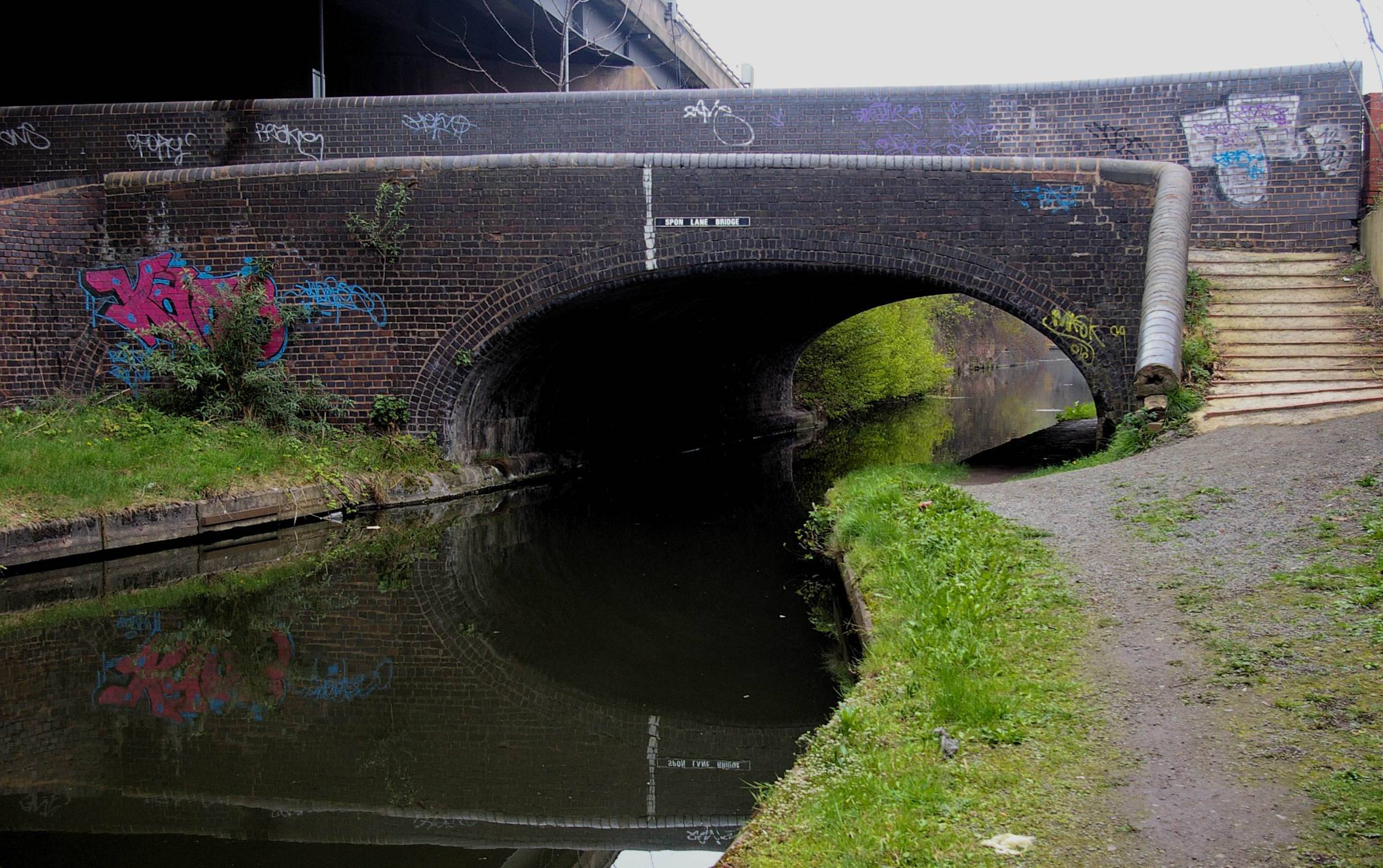
Well Firstly "Smeaton lowered the summit in 1786-87." RE SMETHWICK SUMMIT REDUCTION YE GODS FALSE HISTORY !!!!!!!!!!!!!!!!!!!!!!!!!!!!!!!!!!!!!! John Smeaton provided assistance for the BCN when it was the BIRMINGHAM CANAL NAVIGATION, but the summit reduction was undertaken by their successors Birmingham & Birmingham & Fazeley Canal Company and the work was undertaken under the engineers James Bough and Samuel Bull who were employed by the BBFC. Samuel Bull lived at Smethwick. The work done at Smethwick was a tad later 1788-1791 Smeaton recommended water savings, new water supplies and a canal to Digbeth with engines to back pump the water supply amongst many things in his reports, The need for the Smethwick Summit reduction had been apparent for a time, but new impetus came with the making of Birmingham & Fazeley Canal to Fazeley and the branches at Ryders Green and to Digbeth. Bull and Bough deserve credit in this regard. As to the image yes it is the Junction at Old Turn and Deep Cutting and the view is the bridge over the Oozells Loop which was was the original BCN of 1769. The tube works was Nile Street.
-
Yes it would be lock 9 and 1790 is about right although a couple of years were needed to move the canal. I suppose there are still bits of lock 8 under the motorway piers As to the recent image there was once a tube works beside a street now gone with links to an Egyptian River.
-
If you look close at the image I posted you will see a bricked up arch that was once the entrance to a lock, what lock number was it and when did it cease to be a lock? And another question for the grey cells?
-
You mean this bridge?
-
May be this lock then and the railway bridge
-
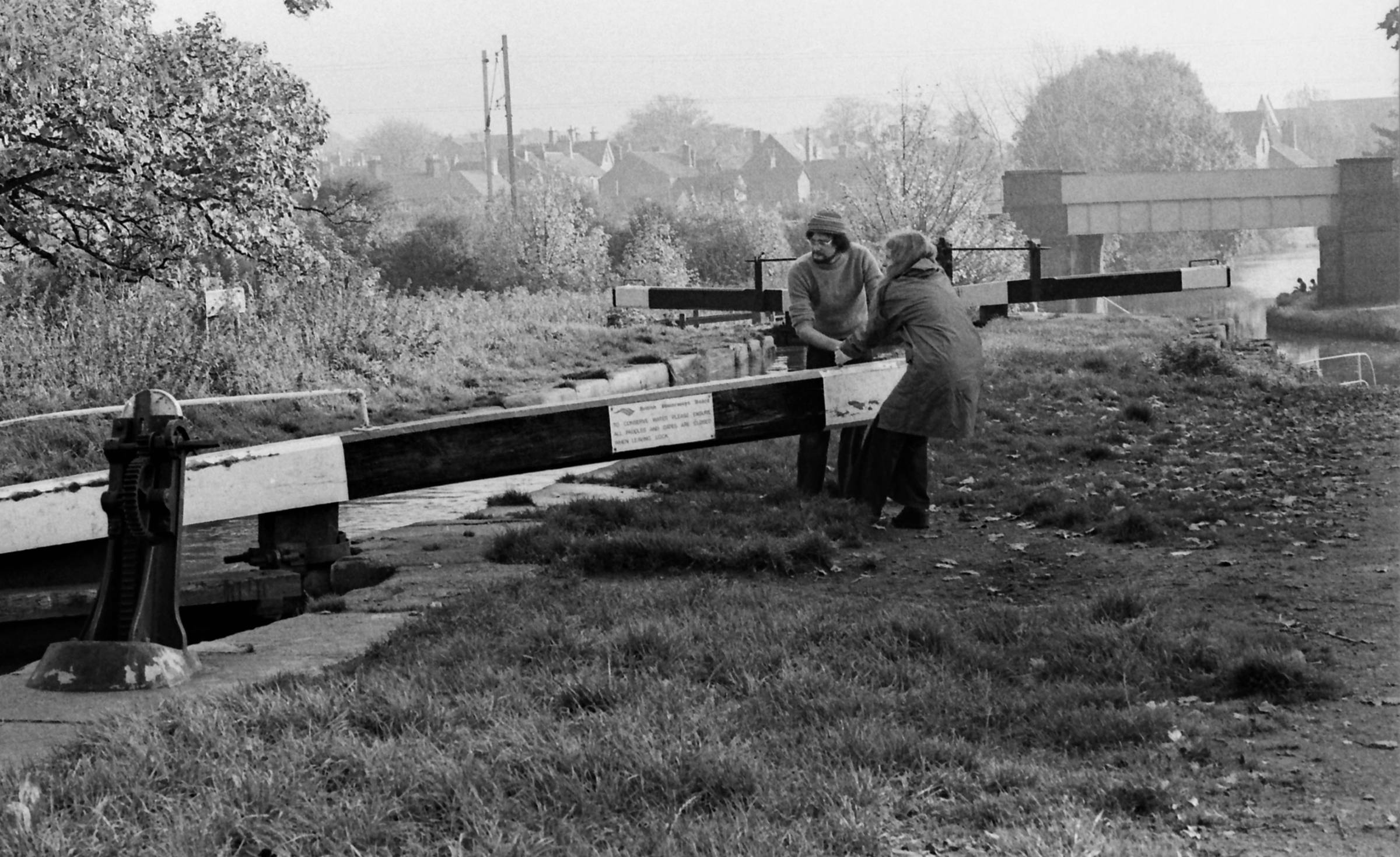
The image is Waterways Archives CRT which states to be by Navigation Bridge Coventry Canal. The main works on the offside were the Edgewick Works, which had a extensive canal frontage. So is the caption correct?
-
Those sunken dayboats along the Walsall Canal...
Heartland replied to davidwheeler's topic in History & Heritage
Laurence did quote some identities for those at Keays Yard and on the town arm so I wonder if anybody did record them. -
The Coventry Canal image is said to be 1970's may be somebody has the tools to work out this Navigation location.
-
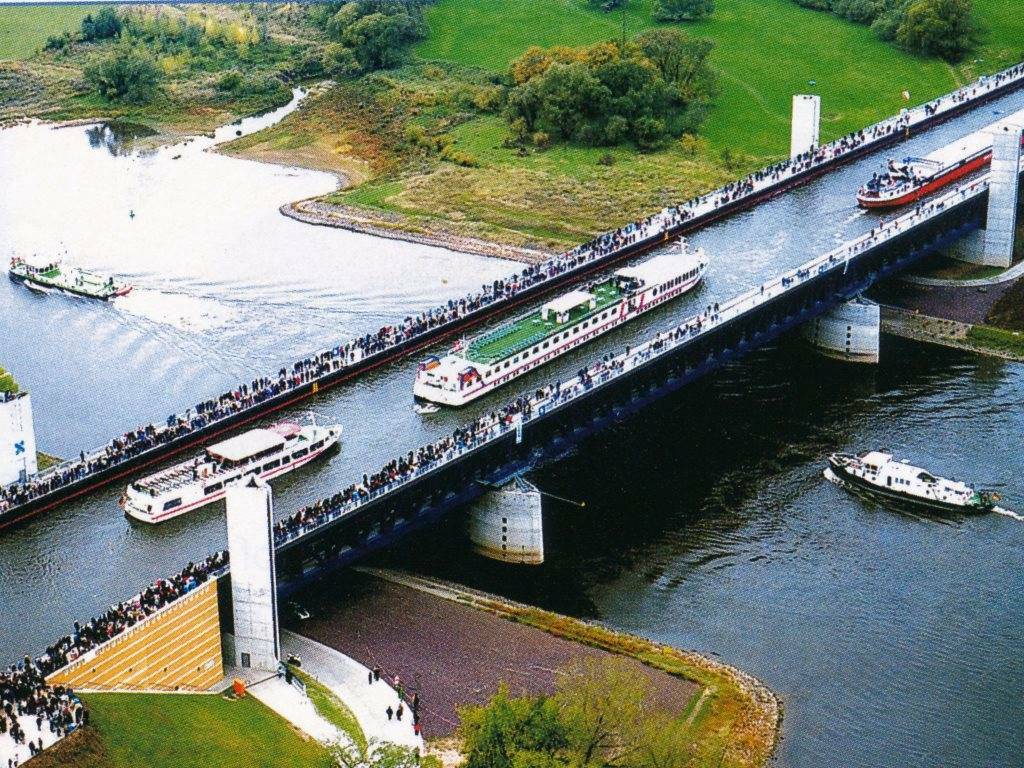
Alan has the answer for Magdeburg As to Mikes question there were early canals in France, and elsewhere, but some sort of clue might assist.
-
I would have thought that locks predated photography So an alternative here is a modern structure to test the grey cells
-
Staying with the Coventry Canal Where and what is this location
-
They do that don't they! Bat out of Hell- a demon cricketer ?
-
Yes it is Glascote Basin, which has links with Samuel Barlow The map for 1901 is perhaps a little sharper. The canal had a few basins here and the triangular basin was the longest. There was a tramway that linked with Glascote and Amington Collieries and sidings of the Midland Railway. The track beside the triangular basin seems to be an interchange line. Glascote Colliery was owned by the Glascote Colliery Co which belonged to the ironmaster family, Firmstone. Much of the Midland Railway sidings were laid in the 1880's. Further south below the locks was the Kettlebrook Colliery Basin and a narrow gauge railway owned by the Dumolos used a Henry Hughes built locomotive for haulage/ The triangular basin is associated with the carrier Samuel Barlow, but he could also have used the Dumolo basin.
-
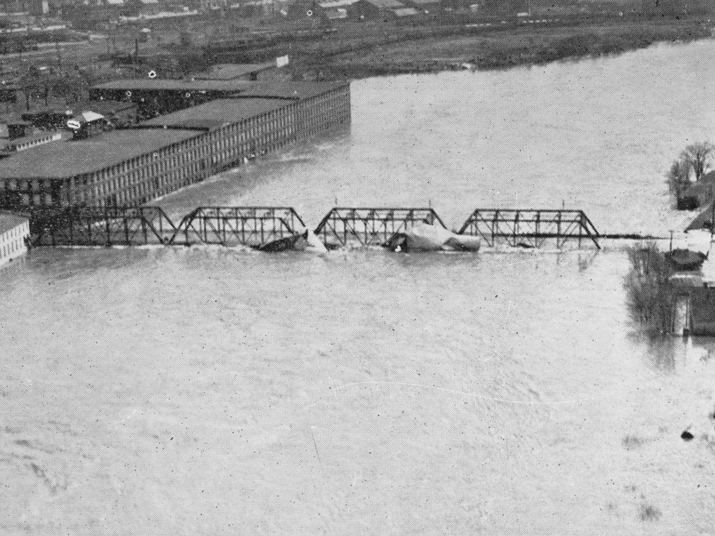
Yus that saves me making the clue about happy coats to keep out the rain. Well done But when the flooding in British Rivers is concerned, they look slight to what happens in America!
-
It is part of a post card which my late Uncle Harold collected and he was killed in a tank battle in World War 2 It is a river and this image of same river is shown passing through a flooded Manchester, but not the one in this country
-
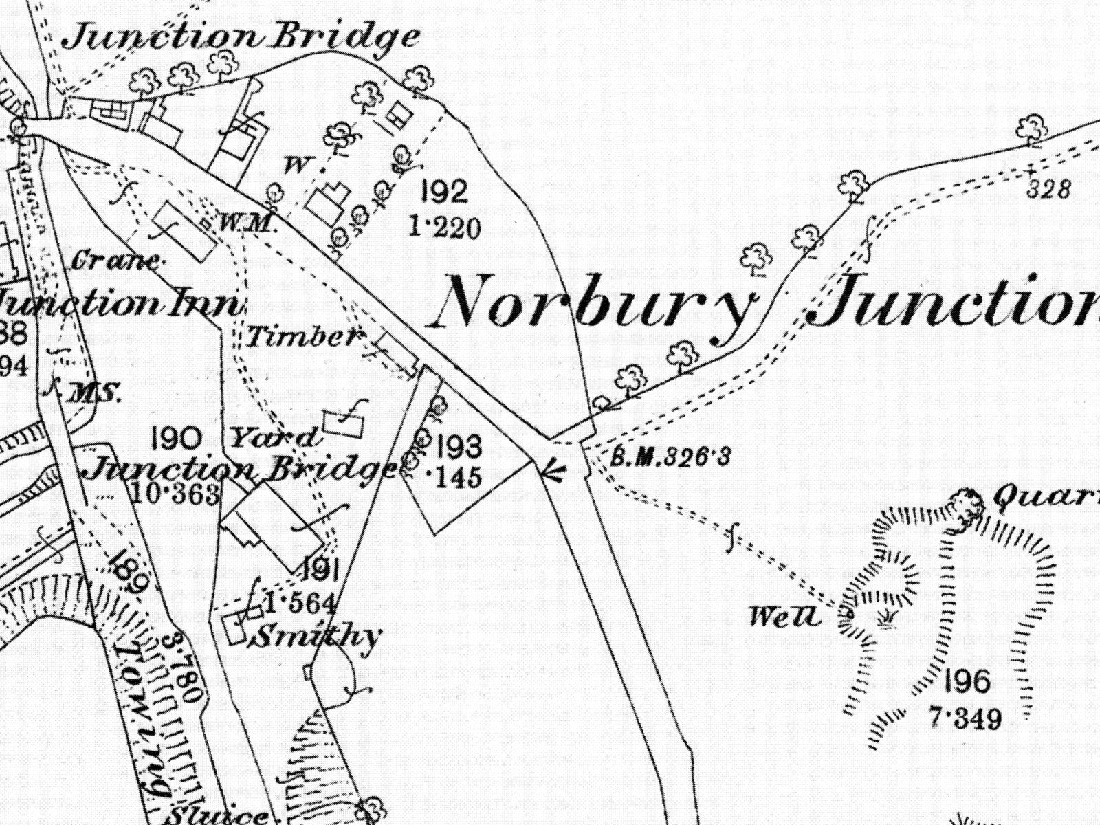
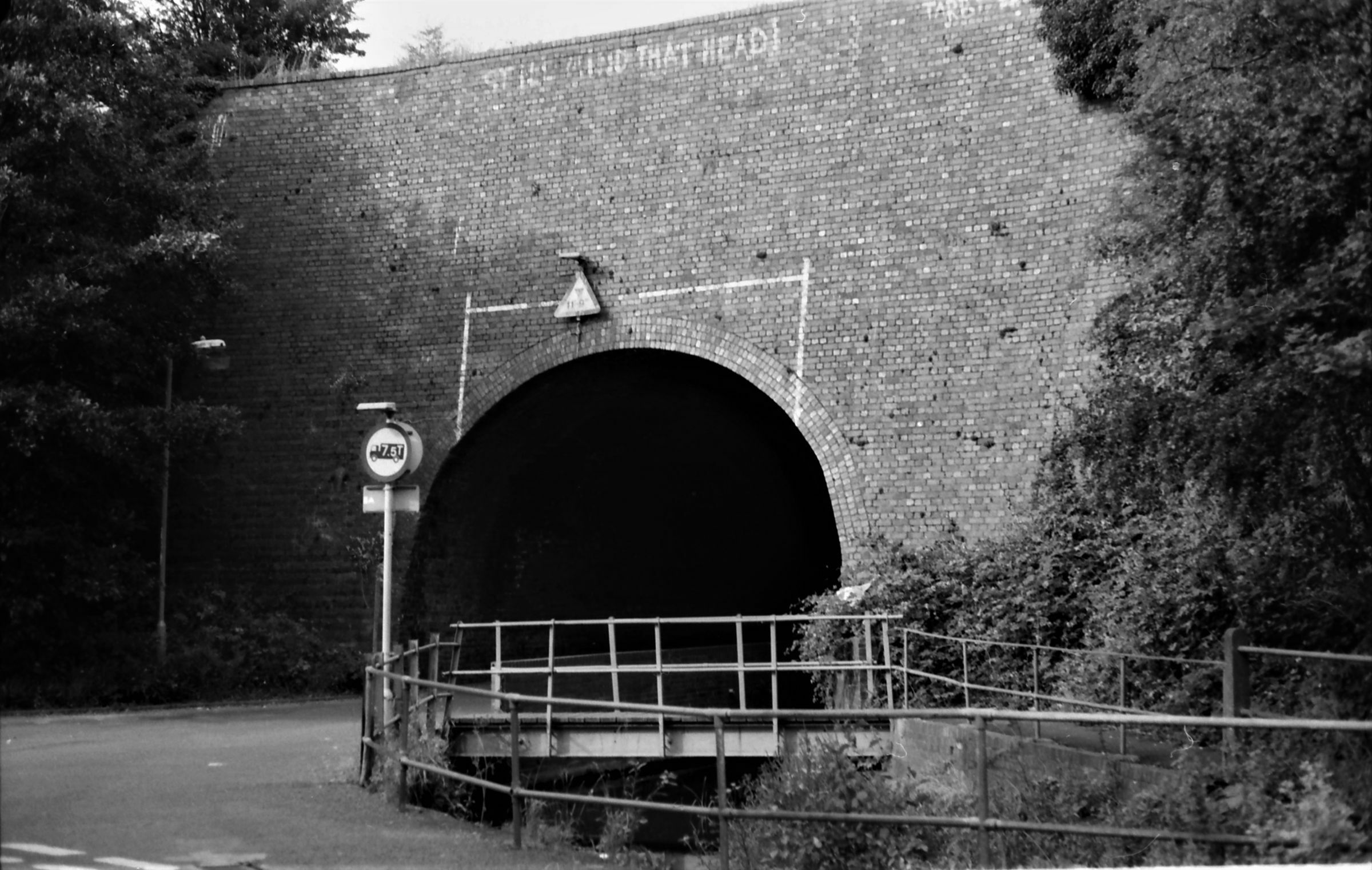
Well done again Norbury Junction and the flight of locks leading down to Newport The view is taken from under the bridge, and another view under a different bridge
-
Another location which some might know on a canal created through the genius of Thomas Telford
-
Somewhere in the United States where it clearly rains. Could this be another type of house boat?
-
Oh yes Shirley Aqueduct This 1903 map view shows the aqueduct A little further north the canal seems to have had a run off following a boundary that went in a straight line to a mill pool for a flour mill/
-
Lock 1 and 9 at the Delph are on the original line the original 8 has been in filled. As to Simkiss, yes they was the now closed local brewery And now a West Midland waterway feature
-
Yes it is on the original line of the Dudley Canal when there were 9 locks and as Thomas Dadford was the engineer there were long pounds and a short distance between some locks. The tithe map shows the original and Ian Langford in 1979 shows where the two cottages are in relation to the diverted canal. Malthouse Stables were a later addition post 1900 in fact and were seemingly part of the joint Shropshire Union/ BCN engineering establishment controlled by G R Jebb.
-
The cottage number 151 should have helped with this one and may be Goliath has some idea where this is and there is a nearby brewery, In fact in times gone by one road had a brewery at both ends. One brewed straw coloured beer and the other brewed darker beer. Sadly the one sold out to a group that closed many real ale pubs and breweries and even shut their own brewery, such was the destiny of the British brewery industry.
-
The warehouse view was at the end of the Lydney Canal and the buildings behind are still there. There are new units there now. Neat this place was the original navigation - Lydney Pill- came up from the Severn and formed a means of transfer to Pidcock & Co Canal Another query then-------
-
Mill Pond or Reservoir? A mill pond provided water for the mill. Having both names given raises the question as to what the reservoir served. If it supplied the mill then why call it a reservoir. At heart of this question is a possibility that the reservoir was a compensation reservoir like those on the Worcester & Birmingham Canal protecting water supplies to the mills on the Ivel.