

Scholar Gypsy
-
Posts
4,948 -
Joined
-
Last visited
-
Days Won
2
Content Type
Profiles
Forums
Events
Gallery
Blogs
Store
Posts posted by Scholar Gypsy
-
-
I also have a spreadsheet, that I am using to show to CRT the slots that I think are needed on each tide during the year. Current version is here, but this is subject to change ....
-
 1
1
-
-
1 minute ago, magnetman said:
I am very interested in the PLA view on all this. I seem to recall a while back there were some rumours around that the PLA may look to ban canal Boats or perhaps require skippers of vessels entering the tideway to have a certificate of some sort.
It might be my imagination but I think they may find the presence of leisure narrow Boats a bit of a nuisance.
Risk assessments &c.
I've not heard any more on this in recent years.
Personally I think the PLA harbourmasters work really hard to allow the smallest thing that will float, and the biggest container ships in the world, to safely co-exist. Supported by the Chief Executive who is (or was!) a tideway rower. I suspect SUPs are more of a nuisance than narrowboats. (see the idiot in the link below)So for example they come down hard on anyone creating excessive wash. For our part, proper preparation and equipment is key, which is why I always react quite volubly when I see people posting on social media saying "a mobile phone is fine, you don't need a VHF radio". That sort of attitude will increase the risk of further regulatory action. It is fair to note that (following an unfortunate incident at Hammersmith a few years ago) the regulations for hire boats on the tideway cannot realistically be complied with by narrowboats - so there aren't any any more.
https://scholargypsy.org.uk/2023/07/13/sup-training/-
2
-
-
Thanks for drawing this thread to my attention. Three representatives (from SPCC, IWA and the DBA/Limehouse residents) had a useful meeting with CRT a few days ago. They have accepted that the current slots offered on the website are not right, and in particular don't allow for the various options for arriving and departing. Watch this space!
A few other points I would add:
- I strongly agree with @Peugeot 106 that the skipper needs to do their own passage planning and understand the tides. One certainly should not rely on a website to tell you when to depart.
- The winter hours (0800-1600) only apply from November to February inclusive. The other 8 months are 0700-1900.
- We are still discussing these hours with CRT. It's not going to be easy to persuade them to change - this is a national policy and one that makes sense in many contexts (but the moon does not cooperate so far as tidal locks are concerned).
- These new hours will mean there are quite a few days, even in summer, where Brentford to Limehouse (and vv) transits are not possible. And some days when Limehouse to/from Teddington is not possible (unless you fancy bashing against the tide)
- CRT have started training people to operate the lock (and the bridge, which is temperamental). I have volunteered myself. Ditto Brentford Thames lock (which is simpler).
- We have been trying to engage the PLA on all this, but no luck yet. I will have another go at their open meeting (they are normally excellent events) in Putney on Monday week.
-
3
-
22 minutes ago, PeterScott said:
Yesterday 2024

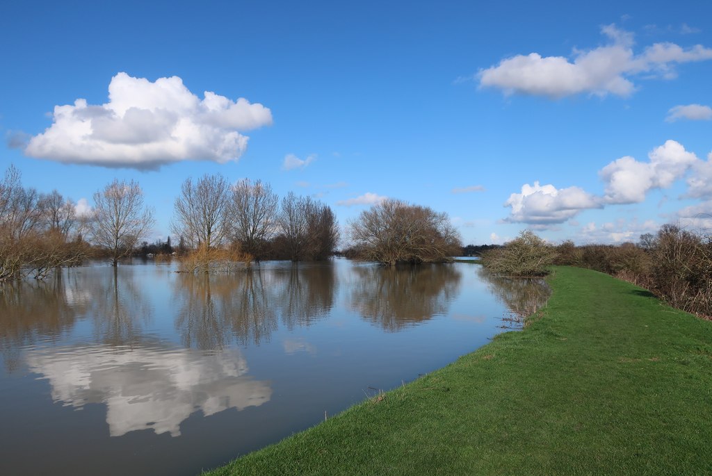
Lots of water in the River Great Ouse, near to Over, Cambridgeshire. half-a-mile south of Pike&Eel Marina
It's pretty high. This gauge tells me that the headroom at Hermitage Lock is only 1.4 metres..
https://www.gaugemap.co.uk/#!Detail/1598/1742 -
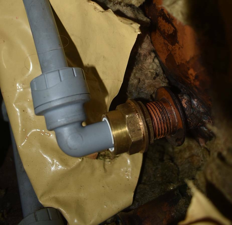
1 minute ago, MtB said:
And yet... there are droplets of water visible on the yellow plastic sheet behind the fitting in your photo!
That was from when I removed the previous fittings. Most of the coolant had been drained into a bucket in the engine room, but not all.... The lagging is also a bit soggy. Any leaks end up in the cabin bilge and are very easy to spot. -
Mark 2: rather better made fittings, which came with both flat and tapered washers. I also added a lock nut, to avoid overtightening. S
o I really don't think this will move again..
-
And here is the sailing equivalent, if your mast is too tall to fit under the bridge ...
-
34 minutes ago, MtB said:
So getting back on topic as per the misleading thread title, I remain to be convinced there is any risk of navigation on the cam being stopped (other than possibly temporarily during actual construction of better sewage treatment plant).
That's our understanding too, after several months of work on the detail. Installing the coffer dam will create an obstruction for a few days, and then removing it ditto. For the 2-4 months inbetween there will be a slight narrowing of the channel, but nothing significant. It will be marked and signed: AW got the point when I said they needed to do better than the HS2 contractors at Denham, who got this wrong in so many ways .....
8 hours ago, matty40s said:Simon, I do not doubt your integrity, and trustworthiness, however, I do doubt the other party.
Why is there such a need for a massive storm drain outlet from a sewage works in a green belt area when they are no longer connected to Cambridges storm drains?
As I said before, my understanding is that the new STW will deal with everything that currently goes into the current STW, and that will include flow from the combined sewer and storm drain network (but not, as now, dedicated storm drains that presumably go straight into the river). The new outfall is explicitly future proofed, and designed to cope with 2 cumecs of treated effluent and 5 cumecs of storm water overflow.
There are currently 912 documents on the website, I certainly haven't read them all, but this gives a flavour of the storage capacity that is currently in place. For short storms that don't fill up the tanks the water will be put through the STW. When storms exceed the storage capacity then the overflow is discharged to the river, to avoid the sewers backing up into homes etc. It's probably a bit out of date as it refers to forthcoming discussions with the EA.
https://infrastructure.planninginspectorate.gov.uk/wp-content/ipc/uploads/projects/WW010003/WW010003-000692-5.4.20.10 ES Volume 4 Chapter 20 Appendix 20.10 Storm model report.pdf -
1 hour ago, Jerra said:
Surely it isn't beyond the abilities of a designer to not reduce the river. With a new treatment plant, they will have no reason to pump sewage into the river as they will have built for extreme conditions. Won't they?
I don't quite understand the point you are making Once constructed, the new outfall will not impact on navigation at all - it will be on or behind the existing line of the river bank (continuing the line of piling under the A14 bridge), and at or below the existing bed of the river.
There will be some modest and temporary impact (2-4 months) on navigation during construction, as temporary coffer dams are required (as for many other projects).1 hour ago, matty40s said:The main problem is Mike, the water companies are taking out billions of pounds in shareholder and directors bonuses and are not only investing nothing in improvements, but they are expecting the taxpayers to pay for those in increased bills whilst still increasing dividends, and debts taken against the assets.
Ofwat, the regulator, is in the pockets of the water companies, (79% of water company directors were part of OFWAT before being directors).
The self regulated outflow monitoring is a joke, most are hiding the figures, changing red to blue or green on the maps to hide the danger....the rest are shocking.
I know Simon(Scholar Gipsy) has the best intentions, but this has gone beyond nice communications and agreeing things.
For a start, why has the storm drain output got the same output capability as the final outlet when the sewage farm is not on the main Cambridge storm drain system any more.
A question that MUST be asked.
My understanding is that the new works will take everything that goes into the existing works - ie from the current combined sewers and storm drains. Hence it will need a storm overflow facility as now (but used less often). Also, the new works and outfall are designed to cope with planned growth in Cambridge ie until 2080 or so. See section 1.6 here.
https://infrastructure.planninginspectorate.gov.uk/wp-content/ipc/uploads/projects/WW010003/WW010003-000535-1.3 Guide to the Application.pdf
Anyway, the planning inspector has already started his work, so your question needs to be directed to that process. The Cam Conservators have quite a narrow remit here, ie the impact on navigation.
-
As an update, this statement was published earlier this month on the Cam Conservators' website. I also attended the meeting with Anglian Water last week, which was very helpful. The task now is to ensure that all the legal documentation matches what we have agreed. Sounds simple, but it really isn't.
"The Conservancy is engaged in positive discussions with Anglian Water around this project. It is considering the potential impacts during :-
The construction phase, which will involve some temporary restrictions to the navigation.
-
The operation of the outlet, it is anticipated that the impact will be minimal.
-
Any necessary maintenance works.
The Conservancy is also working to ensure that any powers granted to Anglian Water in the fulfilment of this project are no more than are necessary."
Pages 7-9 of this (large) document give a rather clearer view of the outfall, which is the main structure we are concerned about. There are also three tunnels, at depths between 4 and 20 metres below the river bed, which will be driven under the river.
https://infrastructure.planninginspectorate.gov.uk/wp-content/ipc/uploads/projects/WW010003/WW010003-000552-4.13 Design Plans - Outfall.pdf -
-
19 minutes ago, David Mack said:
Be careful what you wish for! The concrete cover to the reinforcement is clearly inadequate. The appropriate repair will involve removing any loose concrete, cleaning the reinforcement, replacing any areas which have significantly lost cross section, then covering with a sprayed concrete layer thick enough to protect the reinforcement. That would result in a reduction in the available headroom of 20-50 mm, and possibly more.
I checked the ticket on the Council's website, and it says the following, a few months ago (sorry I should have checked this earlier!):"No action has been taken at this time but we will continue to monitor the problem -We have assessed that the defect does not currently meet our intervention criteria. We will continue to monitor as part of normal scheduled inspections."
-
On 22/01/2024 at 20:23, GUMPY said:
Should I mention airdraft at Upwell🤔
Absolutely. On the second photo, I have reported this in September to Norfolk County Council, as I don't think it is a good sign if you can see the metal bars in a reinforced concrete bridge. They were going to inspect it but I don't know if anything more is happening. Quite apart from bits of concrete landing on you (or even worse your solar panels) there's quite a bit of heavy lorry traffic over this bridge!
-
I believe 60x10 is the maximum for a widebeam at Whittlesea , or 72x7 for a narrowboat, so you should be OK. The locks are 11'6", from memory.
You should talk to the lockkeeper at Salters Lode, to check whether you need to go through on the level (it's a short lock) or can use it in normal mode. I think you should be OK.... Check the ML leaflet
https://middlelevel.wpenginepowered.com/wp-content/uploads/2023/05/Navigation-Notes-2023-web-version-3.pdf
More stuff here.
-
8 hours ago, Midnight said:
Good cos I doubt it could get any worse than that crossing Simon made. Daryl did confess to me that they really should not have been out it those conditions but hey ho they lived to tell the tale. As @Kendorr said "It's a once in a lifetime" thing - for most of us. You may find it exciting at times but you will definitely be happy you did it.
On the day he did say the boat handled the conditions well, and he was glad it wasn't a widebeam - he finds those much less comfortable!
-
8 hours ago, Grassman said:
Thanks Simon. I've watched all your blogs, some several times, and those blogs of you others too, and I still haven't been put off doing it 😀.
Great. Sorry for posting stuff again - I can never remember who I have sent things to....
-
8 minutes ago, Lumisid said:
Again thanks, will you try to get telephone communication with the lock keeper when out on tideway so they know when to expect you and prep the lock. This is essential and was the point of my OP…
I’ve always found the comms with the Limehouse lock keeper very good. They had a mobile and it was straight through every time (lock included!)
Yes, we will.
This does work at Brentford, where there is a phone. Of course there needs to be someone there to answer it.
I've also pointed out to CRT that if VHF is not to be offered then they should paint over the rather large sign on the bridge....
(NB photo also shows the pontoons. They are both back in place, after one went walkabouts a year or two ago.)
-
3 hours ago, Grassman said:
Thanks for the info, links, and videos. As with most things there are pros and cons. For me it definitely won't be the Kings Lynn option, and for the other crossing I'm favouring starting from the Boston end..... at the moment 🙂.
Good plan. Lots to see in Boston, and the Skegness canal is worth a visit
https://scholargypsy.org.uk/2019/06/26/summer-cruise-2-waiting-in-boston/
-
3 hours ago, Tacet said:
A good while back, the lock was meant to be available according to tides and times rules. But it was unreliable and there always seemed to be new, previously undisclosed rule when complaints were laid e.g. the hours were different following a bank holiday or it wasn't available if the rules otherwise meant it would only be open for only one hour.
Seeking to make the east London canals better used, my father sought to collate all the known rules and then wrote a programme to calculate the times for the next year; inputting the tides was a faff.
The timetable was then sent to BWB (for it was they) with a request for confirmation that the times would be as stated. Somewhat to his surprise, confirmation was given together with a request to either buy the programme or have the times calculated. For several years, he produced the timetable under contract.
I've written a similar programme for Brentford (and given it to CRT for free) and will do so for Teddington in due course once the slot timings are finalised. It's easy to download the tidetimes from the PLA's website (three months at a time). One has to be a bit careful about the GMT/BST issue, but it is doable.I should add that CRT do agree that the lock is operable between HW-4 hours and HW+4 hours. The key issue is the shift times/opening hours for the CRT staff who will turn up to operate the lock (as at Brentford now, there will be no resident lockkeepers as such). Watch this space!
-
1
-
-
1 minute ago, Midnight said:
It was amazing how quickly that sandbar disappeared under the incoming tide. After that it was a bit hairy with the tide beam on until we turned into the channel. I got the feeling it was getting marginal when Daryl very softly asked if he could take the tiller at that point. Okay you edited out the bit where Duncan screamed and I sh*t myself. If it had got as bad as Simon's trip I would have left you there and got the bus. Never the less great video memories. Thanks Kevin.I don't think there is a regular bus, although the Hunstanton Flyer does operate a service on request...
https://rnli.org/what-we-do/lifeboats-and-stations/our-lifeboat-fleet/rescue-hovercraft -
46 minutes ago, Kendorr said:
Exciting maybe isn't the right word!
If anybody want's to look, nothing special, but a bit of film I managed to save.
That's a nice video. I liked the way the seal was showing you where to moor. I was impressed that your GPS tracking system measures the calories burnt by the boat. And also a nice demonstration of the mooring procedure at Wisbech (14:00 onwards).
I should note that MIDNIGHT came on the St Pancras Cruising Club trip on the tideway last year, and nothing broke.Here's a short and technically rather rubbish clip of rough water on my first crossing. Daryl said the conditions were marginal (a decent wind from the NNE). A couple of the crew were seasick, but no crockery was broken. A nasty corkscrew motion. As you can see we took a dog leg course to avoid the wind being beam on. Once we turned to the south west (at low tide, so no more wind over tide) everything suddenly got much calmer.
-
1
-
-
Just to add that
- a number of representative bodies are in discussion with CRT about the new arrangements.
- The slots currently offered on the CRT website are sub-optimal, and discussions will happen soon with CRT to improve this.
- We are very seized of the importance of effective comms with the lock keeper en route.
- A key issue is sorting out the operating hours. To date (with prior booking) 0500 to 2200 all year round. This used to be the case at Brentford, but is now 0700 to 1900 (1600 in winter).
Nearly all the relevant websites (PLA, Acquavista, CRT) are now out of date, please don't rely on them. I will be updating http://thamescruising.co.uk/?page_id=648 as soon as I can.
-
3
-
I'm not sure there is a lot to choose between going up or down the Nene. I do both single handed, without too much difficulty. If there's a strong current then I would prefer to go upstream - it's easier to moor, and to control the boat more generally, and you can normally just go straight into the lock (if the guillotines have been left up, as they should be). But if there's a strong current the river is quite likely to be closed to navigation very soon anyway.
As to the Wash, I've done two of the four possibilities: Denver/Kings Lynn to Boston, Boston to Wisbech. The Denver/KL section is quite challenging - lots of mudbanks - but that's why you have a pilot.It's normally best to stop on the way at Wisbech, on the pontoon moorings in the marina. This is probably a bit easier if going from Boston to the Nene. There is plenty of room before you get there to turn round, and then you point downstream, under power, and let the tide carry you backwards / upstream onto the moorings. If you are going from Peterborough/Dog-in-a-Doublet on the ebb then you need to go beyond the marina, turn around, and then punch the tide to get back to the moorings.
Denver/Kings Lynn is trickier, but quite exciting. The mud banks on the tidal Great Ouse do move around quite a bit, and you need to get the timing right in both directions to avoid running out of water.
So in summary I would do Boston to Wisbech, or if you are feeling a bit more adventurous Boston to Denver. Please say hello to Daryl if you use him as your pilot. He requires good quality bacon butties throughout the trip.Lots of resources here: https://scholargypsy.org.uk/washing/ including some annotated photos of Wisbech pages 8 and 8M here (very large file: https://nbsg.files.wordpress.com/2015/04/nene_guide_aug2015.pdf ).
Here is Wisbech.
PS you may find this helpful about the practicalities of visiting the Nene, and/or the Middle Level and the Great Ouse.
https://goba.org.uk/a-guide-for-visitors-to-the-east/-
2
-
-
58 minutes ago, mrsmelly said:
Nice to see a proper old fashioned cannot go wrong method of keeping track of where you have been etc etc. It will last for a hundred years, the batteries will never go flat and can be read instantly. Much better than modern nonsense methods and hope you have leccy, hope the format hasnt changed, hope whoever set the doobrey up on line hasnt switched it off etc etc etc
")
I agree. Here are Scholar Gypsy's logs for the last fifty years. There is also a separate engine log.One of my son's regular crew has produced this (click the link) from a careful analysis of the log for the trips he (the son) has done. (I am Papa, JJ is the son, Tom B is the mathematician friend). Hover your mouse over the chart. May not work on all mobile phones (it does on mine: Chrome on Android)
https://scholar-gypsy.vercel.app/
-
1
-
-
2 hours ago, Tractor said:
Mooring between St Johns Lock and Halfpenny Bridge, Lechlade.
Watch out for Heffers in this field, they go around in a juvenile 'mob', and will not only lick the boat, and lean on it, but try to eat the rubber window surrounds and the cratch cover
A guy will turn up to collect mooring fees, to explain all this but before this be on the look out for the Heffers.
The cows are not there this week (photo by Maria S on Facebook). I think this photo is taken from Halfpenny Bridge.
-
1
-
 o I really don't think this will move again..


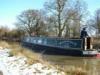
Tidal Thames.
in General Boating
Posted
That is an error. High Water London Bridge is 0600 (BST) that day, so you would be punching the tide all the way to Teddington (Brentford would shut at 0900, and you won't get there in time). The website offers a slot between 0200 and 0600 - which as I say is an error - and you would want to leave at about 0300.
I would suggest using the afternoon tide, and leaving Limehouse at about 1500. HWLB is 1815. That should enable you to go to Brentford (shuts 1900) or Teddington (open 24/7).